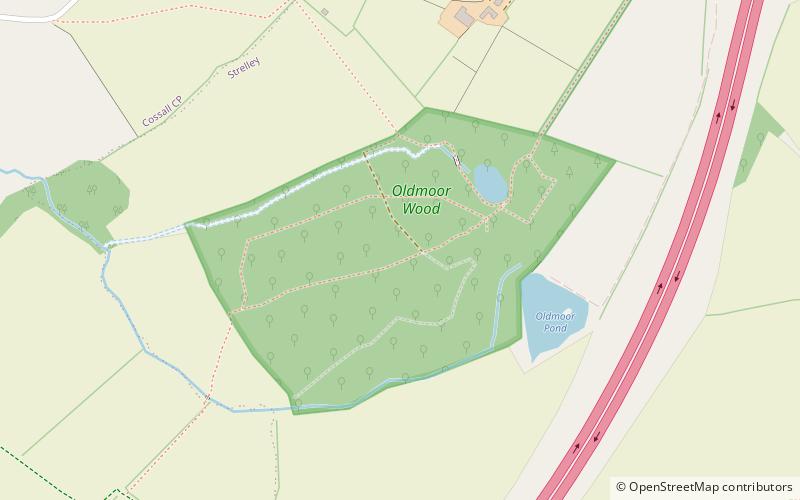
Oldmoor Wood, Nottingham
Map
Facts and practical information
Oldmoor Wood is a woodland in Nottinghamshire, England, near the village of Strelley. It covers a total area of 15.11 hectares. It is owned and managed by the Woodland Trust. During early spring, Oldmoor Woods is blanketed in a carpet of English and Spanish bluebells. ()
Coordinates: 52°58'19"N, 1°15'37"W
Getting there by public transportation
Public transportation stops near this location
- Bus
 Bus
Bus
- Calculate routeGreymede Avenue 27 min walk
- Calculate routeBilborough Road 27 min walk
- Calculate routeUnderwood Mews 27 min walk
- Calculate routeStrelley Village 28 min walk
Day trips


Frequently Asked Questions (FAQ)
Which popular attractions are close to Oldmoor Wood?
Nearby attractions include Created By Hand, Nottingham (14 min walk), All Saints' Church, Nottingham (15 min walk).
How to get to Oldmoor Wood by public transport?
The nearest stations to Oldmoor Wood:
Bus
Bus
- Greymede Avenue • Lines: L2 (27 min walk)
- Bilborough Road • Lines: L2, L3, W3 (27 min walk)