Ullscarf, Grasmere
#39 among attractions in Grasmere
![Ullscarf location map](https://tzmedia.b-cdn.net/media/images/static-maps/gb/54_5007_-3_09651.jpg)
Facts and practical information
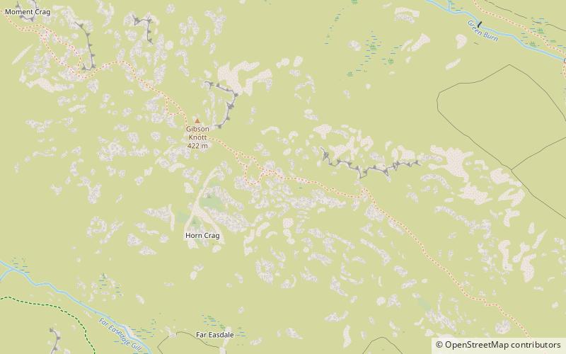
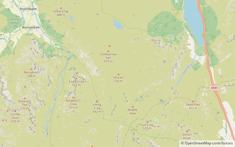
Ullscarf is a fell in the English Lake District close to the geographical centre of the Cumbrian hills. It forms part of the watershed between the Derwentwater and Thirlmere catchments, a ridge running broadly north-south. ()
Grasmere United Kingdom
Grasmere plan & book
Unleash the traveler in you — discover the cheapest flight deals, find the perfect hotel or hostel nearby, and search for the best car rental prices. Travel at your own pace to discover new places and enjoy your journey.
Ullscarf – popular in the area (distance from the attraction)
Nearby attractions include: Pavey Ark, Easedale Tarn, Great Crag, High Raise.
2.7 miSNature, Natural attraction, CliffPavey Ark
70 min walk • Pavey Ark, with its imposing presence in the United Kingdom's Lake District, is a rugged cliff face that commands respect and admiration from hikers and climbers alike. As part of the Langdale Pikes, it looms over the serene Stickle Tarn, offering a formidable...
2.4 miSENature, Natural attraction, LakeEasedale Tarn, Grasmere
62 min walk • Easedale Tarn is a tarn in the centre of the English Lake District, about two miles west of the village of Grasmere. It lies in a hollow between Tarn Crag to the north and Blea Rigg to the south, about 910 feet or 280 metres above sea level.
2 miNWHillGreat Crag, Borrowdale
52 min walk • Great Crag is a fell in the English Lake District, located near the hamlets of Rosthwaite and Stonethwaite in Borrowdale.
1.8 miSNature, Natural attraction, HillHigh Raise
46 min walk • High Raise is a fell in the Central Fells of the English Lake District, not to be confused with another High Raise situated in the Far Eastern Fells.
1.2 miSWNature, Hill, Natural attractionSergeant's Crag, Lake District National Park
31 min walk • Sergeant's Crag is a fell in the English Lake District. It is an intermediate height on the ridge between the Langstrath and Greenup valleys in the Central Fells.
1.3 miSENature, Natural attraction, HillCalf Crag, Grasmere
34 min walk • Calf Crag is a fell in the English Lake District, on the eastern side of the High Raise massif.
2 miSENature, Natural attraction, HillTarn Crag, Grasmere
52 min walk • Tarn Crag is a fell in the Central Fells of the English Lake District. Strictly the name refers only to the rock face looking down upon Easedale Tarn, but Alfred Wainwright applied it to the entire ridge lying between the Easedale and Far Easedale valleys in his Pictorial Guide...
2.2 miSENature, Natural attraction, HillGibson Knott, Grasmere
58 min walk • Gibson Knott is a fell in the English Lake District, an intermediate height on the ridge between Greenburn and Far Easedale in the Central Fells.
2.2 miNEChurchWythburn Church, Grasmere
57 min walk • Wythburn Church is located in an isolated position by the A591 road on the east bank of Thirlmere, Cumbria, England. It is an active Anglican church in the deanery of Derwent, the archdeaconry of West Cumberland, and the diocese of Carlisle.
2.8 miSWVolcano, Nature, Natural attractionScafells, Lake District National Park
72 min walk • Scafells, also known as the Scafell Massif, is a collective term for the Scafell range of fells in the western English Lake District, including Scafell, England's tallest mountain Scafell Pike, Broad Crag and Ill Crag. Great End, Lingmell and Slight Side are also usually included within the definition.
2.3 miENature, Natural attraction, Mountain passDunmail Raise, Grasmere
58 min walk • Dunmail Raise is the name of a large cairn in the English Lake District, which may have been an old boundary marker. It has given its name to the mountain pass of Dunmail Raise, on which it stands.