Trek Zone

Penponds Viaduct, Camborne

#8 among attractions in Camborne

Archaeological site
Penponds Viaduct location map
Map

Facts and practical information
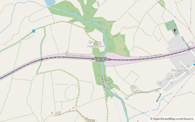
Opened: 1888 (136 years ago)Length: 338 ftCoordinates: 50°12'18"N, 5°19'22"W
Address

Camborne United Kingdom

ContactAdd
Social media
Add
Day trips

Penponds Viaduct – popular in the area (distance from the attraction)

Nearby attractions include: Great Flat Lode, Carn Brea Castle, Carn Brea, Tehidy Country Park.

  • great flat lode camborne3.6 miE
  • carn brea castle redruth3.6 miE
  • carn brea camborne3.4 miE
  • tehidy camborne2.7 miN
  • godrevy lighthouse4.3 miNW
  • the bucket of blood hayle4.1 miW
  • st gothians church3 miW
  • gwinear pitch putt hayle2.2 miSW
  • st martin and st meriadocs church camborne1.1 miNE
  • heartlands cornwall camborne location map
    2.4 miNE
  • king edward mine camborne2.3 miE

Where to next? Visit england England region page or discover the top tourist attractions in United Kingdom.