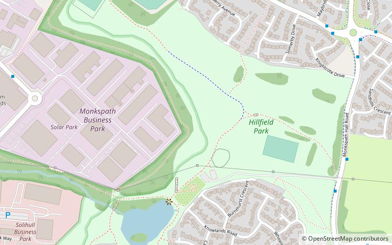
Hillfield Park, Solihull
Map
Facts and practical information
Hillfield Park, Solihull, West Midlands is a community open space and play park in Monkspath, Solihull. It covers an area of over 2 acres and includes an attractive lake surrounded by formal footpaths, which give walkers the opportunity to explore the open space. It is built on a landfill site, its contours being produced by the earth settling as gases escape. ()
Created: 1984Elevation: 436 ft a.s.l.Coordinates: 52°23'43"N, 1°47'35"W
Getting there by public transportation
Public transportation stops near this location
- Train
 Train
Train
- Calculate routeWidney Manor 21 min walk
Day trips


Frequently Asked Questions (FAQ)
How to get to Hillfield Park by public transport?
The nearest stations to Hillfield Park:
Train
Train
- Widney Manor (21 min walk)