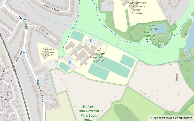
Solihull Sixth Form College, Solihull
Map
Facts and practical information
Solihull Sixth Form College is a further education college for students aged 16 to 19. It is situated on the outskirts of Solihull in the West Midlands and draws students from across Solihull and Birmingham. Founded in 1974, the college consists of several large buildings on a single site. ()
Coordinates: 52°24'20"N, 1°46'16"W
Getting there by public transportation
Public transportation stops near this location
- Bus
- Train
 Bus
Bus
- Calculate routeWarwick Road / Marsh Lane 13 min walk
- Calculate routeWarwick Road / Solihull School 15 min walk
- Calculate routeHampton Lane / School Lane 16 min walk
- Calculate routeWidney Manor 17 min walk
- Calculate routeSolihull 25 min walk
Day trips


Frequently Asked Questions (FAQ)
Which popular attractions are close to Solihull Sixth Form College?
Nearby attractions include Malvern & Brueton Park, Solihull (6 min walk), St Alphege Church, Solihull (11 min walk), Sandalls Cottage, Solihull (12 min walk), Solihull School, Solihull (17 min walk).
How to get to Solihull Sixth Form College by public transport?
The nearest stations to Solihull Sixth Form College:
Bus
Train
Bus
- Warwick Road / Marsh Lane • Lines: 87, 87A (13 min walk)
- Warwick Road / Solihull School • Lines: 87, 87A, X20 (15 min walk)
Train
- Widney Manor (17 min walk)
- Solihull (25 min walk)