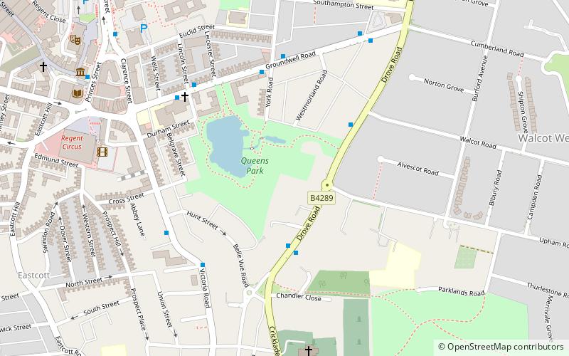
Queens Park, Swindon
Map
Facts and practical information
Queens Park is a public park in the centre of the town of Swindon, England, east of the Regent Circus area. ()
Elevation: 367 ft a.s.l.Coordinates: 51°33'25"N, 1°46'30"W
Address
Swindon
ContactAdd
Social media
Add
Getting there by public transportation
Public transportation stops near this location
- Bus
- Train
 Bus
Bus
- Calculate routeCirencester Road 3 min walk
- Calculate routeWalcot Road 3 min walk
- Calculate routeYork Road 5 min walk
- Calculate routeSwindon 20 min walk
Day trips


Frequently Asked Questions (FAQ)
Which popular attractions are close to Queens Park?
Nearby attractions include Holy Rood Church, Swindon (5 min walk), Christ Church, Swindon (6 min walk), Swindon Meca, Swindon (7 min walk), Museum of Computing, Swindon (8 min walk).
How to get to Queens Park by public transport?
The nearest stations to Queens Park:
Bus
Train
Bus
- Cirencester Road • Lines: 71 (3 min walk)
- Walcot Road • Lines: 71 (3 min walk)
Train
- Swindon (20 min walk)