King Edward VII Bridge, Newcastle upon Tyne
Map

Gallery

Facts and practical information
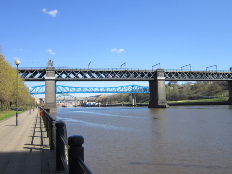
The King Edward VII Bridge is a railway bridge spanning the River Tyne between Newcastle upon Tyne and Gateshead, in North East England. It is a Grade II listed structure. The King Edward VII bridge has been described as “Britain’s last great railway bridge”. ()
Opened: 1 October 1906 (119 years ago)Length: 1151 ftWidth: 50 ftCoordinates: 54°57'49"N, 1°36'60"W
Address
WestgateNewcastle upon Tyne
ContactAdd
Social media
Add
Day trips
King Edward VII Bridge – popular in the area (distance from the attraction)
Nearby attractions include: Centre for Life, Tup Tup Palace, Metro Radio Arena, Newcastle Castle.
Frequently Asked Questions (FAQ)
Which popular attractions are close to King Edward VII Bridge?
Nearby attractions include Queen Elizabeth II Bridge, Newcastle upon Tyne (4 min walk), Redheugh Bridge, Newcastle upon Tyne (4 min walk), Metro Radio Arena, Newcastle upon Tyne (7 min walk), Fahrenheit - Genting Casino Newcastle, Newcastle upon Tyne (8 min walk).
How to get to King Edward VII Bridge by public transport?
The nearest stations to King Edward VII Bridge:
Bus
Train
Light rail
Bus
- Redheugh Bridge Road-N/B • Lines: 97 (7 min walk)
- Central Station Neville Street • Lines: 1, 97 (10 min walk)
Train
- Newcastle (9 min walk)
- Manors (20 min walk)
Light rail
- Central Station • Lines: Green, Yellow (11 min walk)
- Gateshead • Lines: Green, Yellow (13 min walk)


