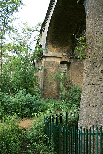
Wharncliffe Viaduct, London
Map

Gallery

Facts and practical information
The Wharncliffe Viaduct is a brick-built viaduct that carries the Great Western Main Line railway across the Brent Valley, between Hanwell and Southall, Ealing, UK, at an elevation of 20 metres. The viaduct, built in 1836–7, was constructed for the opening of the Great Western Railway. It is situated between Southall and Hanwell stations, the latter station being only a very short distance away to the east. ()
Completed: 1837 (189 years ago)Length: 886 ftWidth: 56 ftCoordinates: 51°30'40"N, 0°20'38"W
Address
Ealing (Hanwell)London
ContactAdd
Social media
Add
Day trips
Wharncliffe Viaduct – popular in the area (distance from the attraction)
Nearby attractions include: Brent Valley Golf Course, The Fox, Southall Railway Centre, Hanwell Zoo.
Frequently Asked Questions (FAQ)
Which popular attractions are close to Wharncliffe Viaduct?
Nearby attractions include Hanwell Zoo, London (6 min walk), Hanwell, London (10 min walk), City of Westminster Cemetery, London (16 min walk), Three Bridges, London (18 min walk).
How to get to Wharncliffe Viaduct by public transport?
The nearest stations to Wharncliffe Viaduct:
Bus
Train
Metro
Bus
- Half Acre Road • Lines: 195, 207, 427, 483, E8, N207, N83 (6 min walk)
- St Bernard's Gatehouse / Windmill Park • Lines: 195, 207, 282, 427, 483, 92, N207 (8 min walk)
Train
- Hanwell (6 min walk)
- Drayton Green (18 min walk)
Metro
- Boston Manor • Lines: Piccadilly (35 min walk)

 Tube
Tube


