Anfield Cemetery, Liverpool
Map

Gallery

Facts and practical information
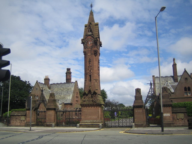
Anfield Cemetery, or the City of Liverpool Cemetery, is located in Anfield, a district of Liverpool, Merseyside, England. It lies to the northeast of Stanley Park, and is bounded by Walton Lane to the west, Priory Road to the south, a railway line to the north, and the gardens of houses on Ince Avenue to the east. The cemetery grounds are included in the National Register of Historic Parks and Gardens at Grade II*. ()
Established: 1863 (163 years ago)Coordinates: 53°26'18"N, 2°57'26"W
Day trips
Anfield Cemetery – popular in the area (distance from the attraction)
Nearby attractions include: Anfield, Goodison Park, Stanley Park, St Luke's Church.
Frequently Asked Questions (FAQ)
Which popular attractions are close to Anfield Cemetery?
Nearby attractions include Walton, Liverpool (9 min walk), Stanley Park, Liverpool (9 min walk), Goodison Park, Liverpool (10 min walk), St Luke's Church, Liverpool (11 min walk).
How to get to Anfield Cemetery by public transport?
The nearest stations to Anfield Cemetery:
Train
Bus
Train
- Kirkdale (26 min walk)
Bus
- Rocky Lane/Belmont Rd • Lines: 18 (32 min walk)
- West Derby Rd/Tuebrook Bridge • Lines: 18 (35 min walk)


