Ferry Road, Edinburgh
Map

Gallery

Facts and practical information
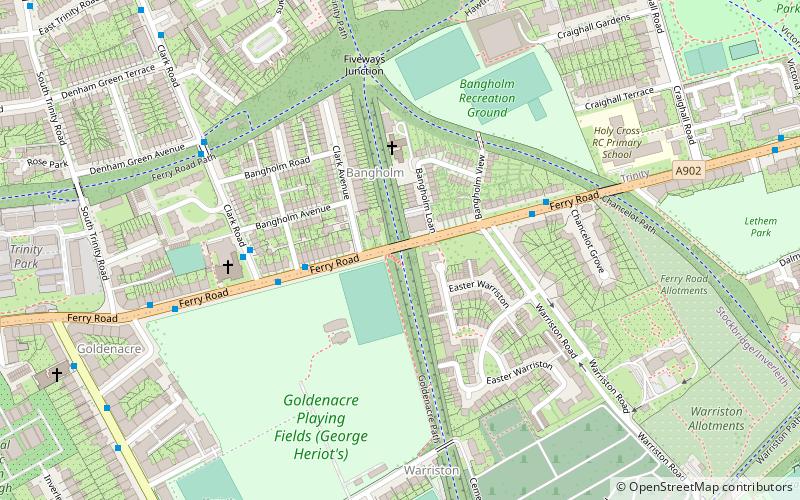
Ferry Road is one of the major roads of Edinburgh, Scotland, deriving its name from being the road from Queensferry to Leith. It runs from the eastern end of Davidson's Mains village in the west, to Leith in the east, passing through Drylaw, Crewe Toll and Goldenacre on the way. It is classified as the A902 from Leith to Crewe Toll where the A902 continues as Telford Road. ()
Coordinates: 55°58'19"N, 3°12'6"W
Address
WarristonEdinburgh
ContactAdd
Social media
Add
Day trips
Ferry Road – popular in the area (distance from the attraction)
Nearby attractions include: The Grange Club, Inverleith House, Edinburgh Sculpture Workshop, Warriston Cemetery.
Frequently Asked Questions (FAQ)
Which popular attractions are close to Ferry Road?
Nearby attractions include Warriston, Edinburgh (5 min walk), Goldenacre, Edinburgh (7 min walk), Warriston Cemetery, Edinburgh (7 min walk), Powderhall, Edinburgh (14 min walk).
How to get to Ferry Road by public transport?
The nearest stations to Ferry Road:
Bus
Bus
- Bangholm Place • Lines: 21 (3 min walk)
- Warriston Crematorium • Lines: 21 (4 min walk)


