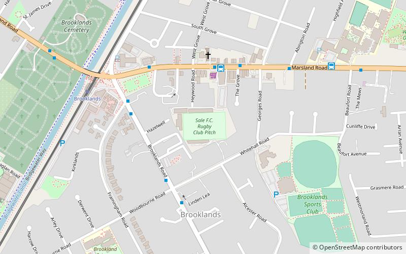
Heywood Road, Sale
Map
Facts and practical information
Heywood Road is a rugby stadium in Sale, Greater Manchester, England, which has been the home ground of rugby union side Sale F.C. since 1905. It was the home ground of spin-off professional club Sale Sharks until they moved to Edgeley Park, Stockport, in 2003. Sale Sharks' 'A' team, the Sale Jets, still play at Heywood Road. ()
Opened: 1905 (121 years ago)Capacity: 3387Coordinates: 53°24'58"N, 2°19'17"W
Address
BrooklandsSale
ContactAdd
Social media
Add
Getting there by public transportation
Public transportation stops near this location
- Bus
- Tram
 Bus
Bus
- Calculate routeBrooklands 6 min walk
- Calculate routeSale 15 min walk
- Calculate routeDane Road 27 min walk
- Calculate routeTimperley 28 min walk
- Calculate routeSale, Northenden Road / near Wardle Road 15 min walk
- Calculate routeRiddings Road/Woodhouse Lane East 15 min walk
- Calculate routeSale Moor, Northenden Road / near Derbyshire Road 15 min walk
Day trips


Frequently Asked Questions (FAQ)
Which popular attractions are close to Heywood Road?
Nearby attractions include Walkden Gardens, Sale (11 min walk), Walton Park, Sale (11 min walk), Brooklands, Sale (12 min walk), St John the Divine, Sale (13 min walk).
How to get to Heywood Road by public transport?
The nearest stations to Heywood Road:
Tram
Bus
Tram
- Brooklands • Lines: Altr, Bury, Picc (6 min walk)
- Sale • Lines: Altr, Bury, Picc (15 min walk)
Bus
- Sale, Northenden Road / near Wardle Road • Lines: X5 (15 min walk)
- Riddings Road/Woodhouse Lane East • Lines: 20 (15 min walk)