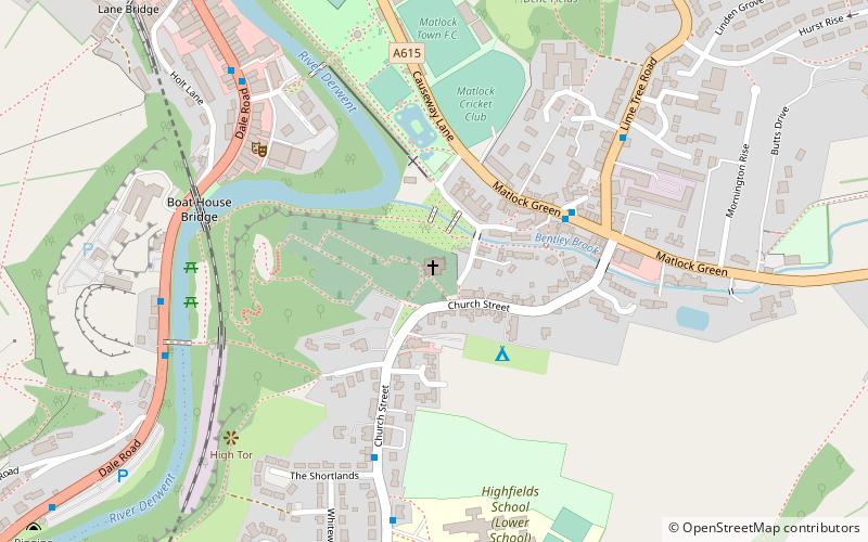
St Giles' Church, Matlock

Gallery (1)
Map
Map
Facts and practical information
St Giles' Church, Matlock is a Grade II* listed parish church in the Church of England in Matlock, Derbyshire. ()
Coordinates: 53°8'3"N, 1°33'7"W
Getting there by public transportation
Public transportation stops near this location
- Bus
- Train
 Bus
Bus
- Calculate routeRed Lion 4 min walk
- Calculate routeMatlock Green/Lime Tree Road 5 min walk
- Calculate routeBoat House 6 min walk
- Calculate routeMatlock 10 min walk
- Calculate routeMatlock Riverside 20 min walk
- Calculate routeMatlock Bath 22 min walk
Day trips


Frequently Asked Questions (FAQ)
Which popular attractions are close to St Giles' Church?
Nearby attractions include The Loft : Matlock, Matlock (9 min walk), Matlock Bridge, Matlock (10 min walk), St John the Baptist's Chapel, Matlock (12 min walk), Riber Castle, Matlock (15 min walk).
How to get to St Giles' Church by public transport?
The nearest stations to St Giles' Church:
Bus
Train
Bus
- Red Lion • Lines: X17 (4 min walk)
- Matlock Green/Lime Tree Road • Lines: X17 (5 min walk)
Train
- Matlock (10 min walk)
- Matlock Riverside (20 min walk)