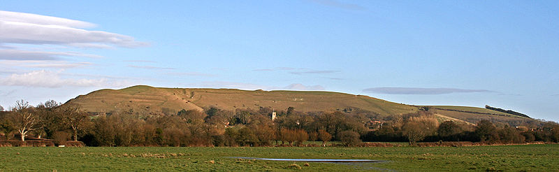
Hambledon Hill

Gallery (4)
Map

Map
Gallery
Facts and practical information
Hambledon Hill is a prehistoric hill fort in Dorset, England, situated in the Blackmore Vale five miles northwest of Blandford Forum. The hill itself is a chalk outcrop, on the southwestern corner of Cranborne Chase, separated from the Dorset Downs by the River Stour. It is owned by the National Trust. ()
Elevation: 630 ftCoordinates: 50°54'39"N, 2°13'18"W
Day trips