RAF Davidstow Moor
#2122 among destinations in the United Kingdom


Facts and practical information
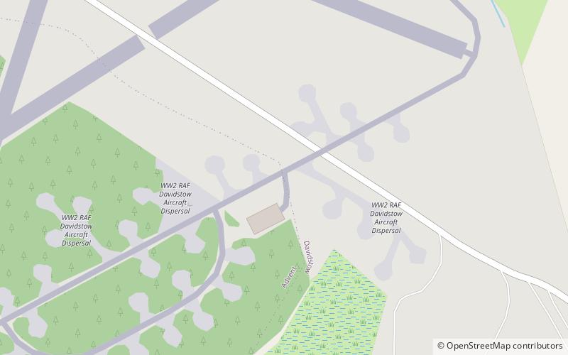
Royal Air Force Davidstow or more commonly RAF Davidstow Moor is a former Royal Air Force station located 2.9 miles north east of Camelford, Cornwall and 11.5 miles west of Launceston, Cornwall, England. ()
EnglandUnited Kingdom
RAF Davidstow Moor – popular in the area (distance from the attraction)
Nearby attractions include: Jamaica Inn, Rough Tor, Brown Willy, St Thomas of Canterbury's Church.
 Pub, Museum, Maritime museum
Jamaica Inn, Redlake Meadows & Hoggs Moor
134 min walk • The Jamaica Inn is a traditional inn on Bodmin Moor in Cornwall in the UK, which was built as a coaching inn in 1750, and has a historical association with smuggling. Located just off the A30, near the middle of the moor close to the hamlet of Bolventor, it was originally used as a staging post for changing horses.
 Archaeological site
Rough Tor, Redlake Meadows & Hoggs Moor
64 min walk • Rough Tor, or Roughtor, is a tor on Bodmin Moor, Cornwall, United Kingdom. The site is composed of the tor summit and logan stone, a neolithic tor enclosure, a large number of Bronze Age hut circles, and some contemporary monuments.
 Nature, Natural attraction, Hill
Brown Willy, Redlake Meadows & Hoggs Moor
75 min walk • Brown Willy is a hill in Cornwall, England, United Kingdom. The summit, at 1,378 feet above sea level, is the highest point of Bodmin Moor and of Cornwall as a whole. It is about 2+1⁄2 miles northwest of Bolventor and 4 miles southeast of Camelford.
 Church
St Thomas of Canterbury's Church, Camelford
74 min walk • St Thomas of Canterbury's Church, Camelford is a church in the Church of England Diocese of Truro in Camelford, Cornwall. It is a chapel-of-ease in the parish of Lanteglos-by-Camelford.
 Church
Minster Church, Boscastle
115 min walk • The civil parishes to which the Forrabury and Minster parish churches belong were united in 1919 to form Forrabury and Minster parish, within Cornwall, England, UK. The main settlement in the parish is Boscastle. The two rectories had been united in 1800.
 Archaeological site
Showery Tor, Redlake Meadows & Hoggs Moor
54 min walk • Showery Tor is a rocky outcrop on a ridge-top approximately 0.6 kilometres north of the Rough Tor summit, near Camelford on Bodmin Moor in Cornwall. It is notable for its rock formations and prehistoric monuments. The Tor is a prominent landmark for a wide area.
 Forts and castles
Warbstow Bury
123 min walk • Warbstow Bury is an Iron Age hillfort about 0.5 miles west of the village of Warbstow, in Cornwall, England. It is a scheduled monument.
 Nature, Natural attraction, Hill
Garrow Tor, Redlake Meadows & Hoggs Moor
98 min walk • Garrow Tor is a bare, tor-crowned hill, 330 metres high, located on Garrow Downs in the northwest of Bodmin Moor in the county of Cornwall, England, UK.
 Nature, Natural attraction, Hill
The Beacon, Redlake Meadows & Hoggs Moor
109 min walk • The Beacon on Hendra Downs is a prominent hill, 369 metres high, located on the northeastern side of Bodmin Moor in the county of Cornwall, England.
 Lake, Body of water, Nature and wildlife
Crowdy Reservoir, Camelford
21 min walk • Crowdy Reservoir is located on Bodmin Moor near Camelford in north Cornwall. It is currently managed, jointly by the South West Lakes Trust and South West Water. There is public access to the reservoir away from the nature reserve.
 Church
St Julitta's Church, Boscastle
117 min walk • St Julitta's Church, St Juliot is a Grade II* listed parish church in the Church of England Diocese of Truro in St Juliot, Cornwall.
