St. Anne's Church, Glasgow
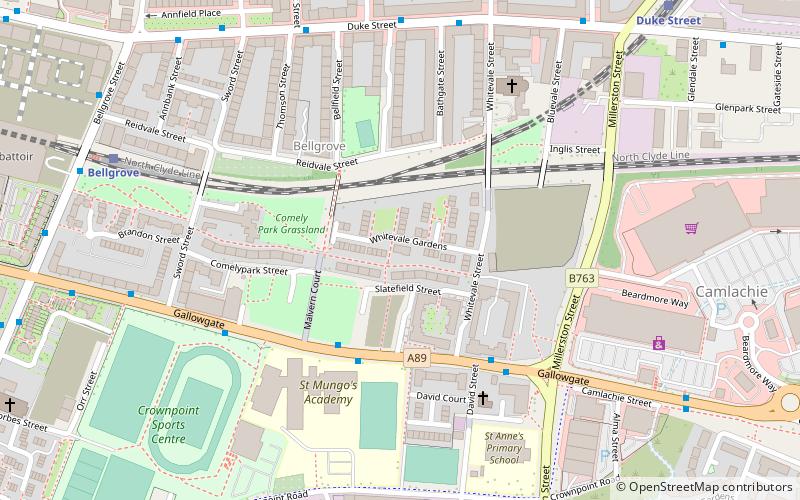
Map
Facts and practical information
St Anne's Church is a parish of the Roman Catholic Church in Glasgow, Scotland, in the Archdiocese of Glasgow. The parish church, situated on Whitevale Street in the Dennistoun area, is a category A listed building. ()
Completed: 1933 (93 years ago)Architectural style: Romanesque revivalCoordinates: 55°51'21"N, 4°13'6"W
Address
East End (Dennistoun)Glasgow
ContactAdd
Social media
Add
Getting there by public transportation
Public transportation stops near this location
- Bus
- Train
 Bus
Bus
- Calculate routeGallowgate / Whitevale Street 3 min walk
- Calculate routeBellgrove 7 min walk
- Calculate routeDuke Street 8 min walk
- Calculate routeBridgeton 15 min walk
- Calculate routeAlexandra Parade 16 min walk
Day trips


Frequently Asked Questions (FAQ)
Which popular attractions are close to St. Anne's Church?
Nearby attractions include Saint Mary's, Glasgow (9 min walk), Barrowfield, Glasgow (10 min walk), Dennistoun, Glasgow (11 min walk), Our Lady of Good Counsel, Glasgow (13 min walk).
How to get to St. Anne's Church by public transport?
The nearest stations to St. Anne's Church:
Bus
Train
Bus
- Gallowgate / Whitevale Street • Lines: 2, 61 (3 min walk)
Train
- Bellgrove (7 min walk)
- Duke Street (8 min walk)