Redland, Bristol

Gallery (1)
Map
Map
Facts and practical information
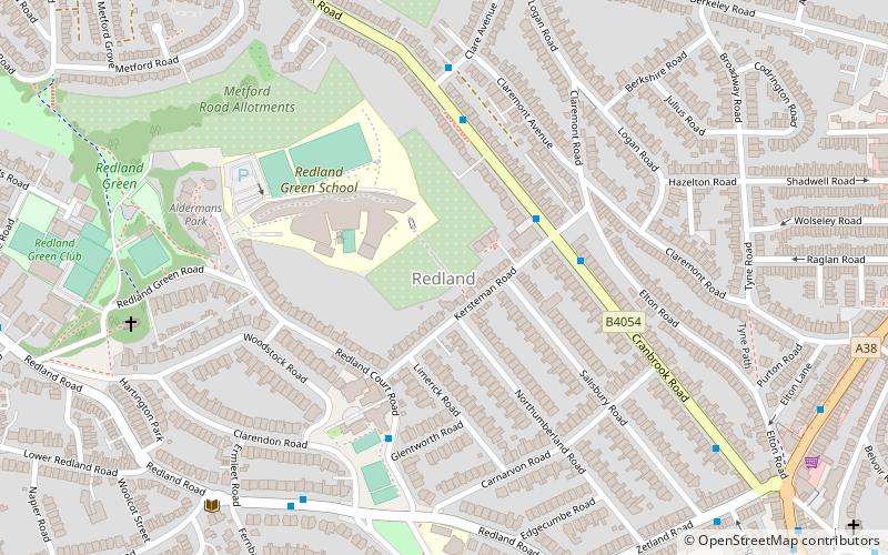
Redland is an affluent suburb in Bristol, England. The suburb is situated between Clifton, Cotham, Bishopston and Westbury Park. The boundaries of the district are not precisely defined, but are generally taken to be Whiteladies Road in the west, the Severn Beach railway line in the south and Cranbrook Road in the east. ()
Coordinates: 51°28'22"N, 2°36'1"W
Address
RedlandBristol
ContactAdd
Social media
Add
Getting there by public transportation
Public transportation stops near this location
- Bus
- Train
 Bus
Bus
- Calculate routeErmleet Road 6 min walk
- Calculate routeRedland Station 9 min walk
- Calculate routeChapel Green Lane 10 min walk
- Calculate routeRedland 9 min walk
- Calculate routeMontpelier 15 min walk
- Calculate routeClifton Down 19 min walk
Day trips


Frequently Asked Questions (FAQ)
Which popular attractions are close to Redland?
Nearby attractions include Redland Chapel, Bristol (7 min walk), Redland Green, Bristol (8 min walk), Rainmaker Gallery, Bristol (13 min walk), Cotham, Bristol (14 min walk).
How to get to Redland by public transport?
The nearest stations to Redland:
Bus
Train
Bus
- Ermleet Road • Lines: 8, 9 (6 min walk)
- Redland Station • Lines: 8, 9 (9 min walk)
Train
- Redland (9 min walk)
- Montpelier (15 min walk)