Totteridge Fields, London

Gallery (1)
Map
Map
Facts and practical information
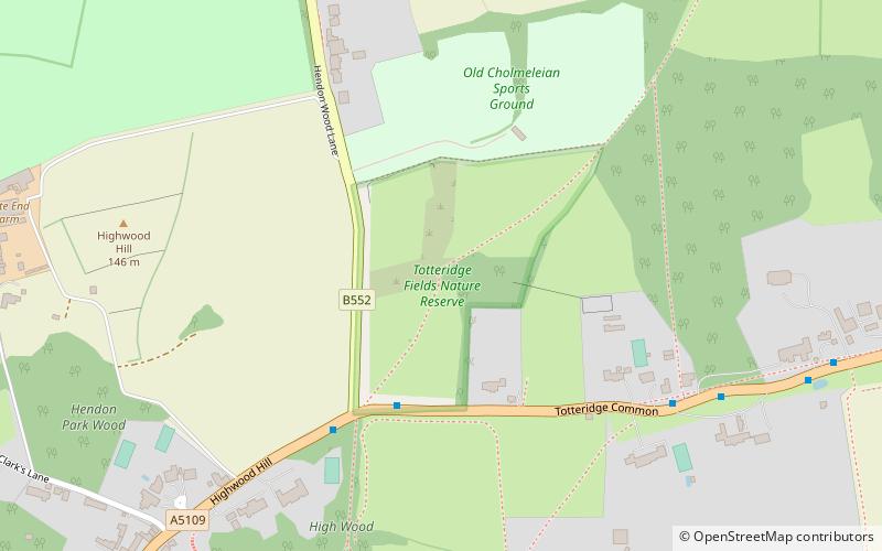
Totteridge Fields is a 97-hectare Site of Metropolitan Importance for Nature Conservation in Totteridge in the London Borough of Barnet. The SINC includes the privately owned Highwood Hill, and at the western end is a seven-hectare Local Nature Reserve owned by Barnet Council and managed by the London Wildlife Trust. ()
Elevation: 374 ft a.s.l.Coordinates: 51°37'56"N, 0°14'4"W
Getting there by public transportation
Public transportation stops near this location
- Bus
 Bus
Bus
- Calculate routeHendon Wood Lane 4 min walk
- Calculate routeWest End House 7 min walk
- Calculate routeSt Edward's College 9 min walk
- Calculate routeMill Hill / The Rising Sun 12 min walk
Maps Tube
Tube
TubeDay trips


Frequently Asked Questions (FAQ)
How to get to Totteridge Fields by public transport?
The nearest stations to Totteridge Fields:
Bus
Bus
- Hendon Wood Lane • Lines: 251, 605, 628, 688 (4 min walk)
- West End House • Lines: 251, 605, 628, 688 (7 min walk)