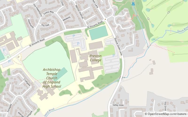
Preston College, Preston

Gallery (1)
Map
Map
Facts and practical information
Preston College is a further education college in the city of Preston, Lancashire, England. The college originally opened as W. R. Tuson College in September 1974 and was renamed Preston College on 1 September 1989. ()
Established: 1974 (52 years ago)Coordinates: 53°47'5"N, 2°41'58"W
Getting there by public transportation
Public transportation stops near this location
- Bus
 Bus
Bus
- Calculate routeSt Clares Church 10 min walk
- Calculate routeWithy Trees 17 min walk
Day trips


Frequently Asked Questions (FAQ)
Which popular attractions are close to Preston College?
Nearby attractions include Christ Church, Preston (14 min walk), Fulwood, Preston (15 min walk), Lancashire Infantry Museum, Preston (18 min walk).
How to get to Preston College by public transport?
The nearest stations to Preston College:
Bus
Bus
- St Clares Church • Lines: 40A (10 min walk)
- Withy Trees • Lines: 40, 41 (17 min walk)