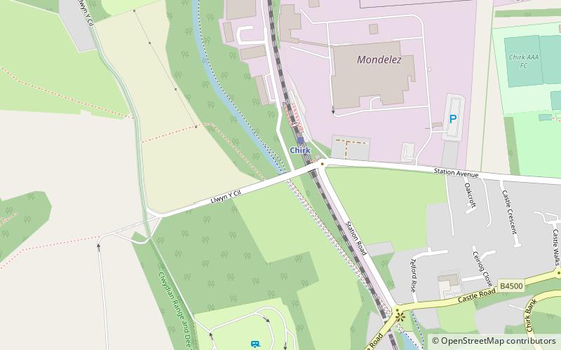
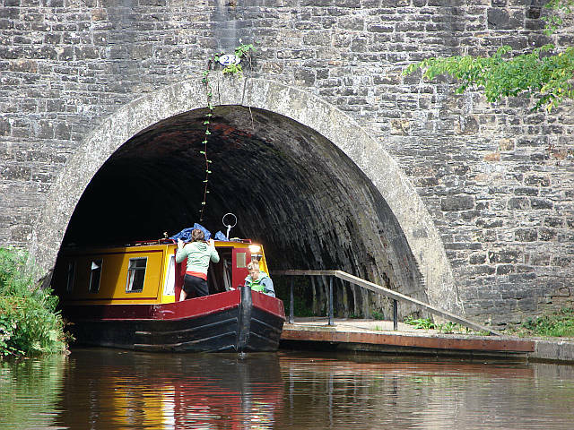
Chirk Tunnel, Chirk
#4 among attractions in Chirk

Facts and practical information
Chirk Tunnel is a canal tunnel near Chirk, Wales. ()
Chirk United Kingdom
Chirk plan & book
Unleash the traveler in you — discover the cheapest flight deals, find the perfect hotel or hostel nearby, and search for the best car rental prices. Travel at your own pace to discover new places and enjoy your journey.
Chirk Tunnel – popular in the area (distance from the attraction)
Nearby attractions include: Pontcysyllte Aqueduct, Chirk Castle, Plas Newydd, Trevor Basin.

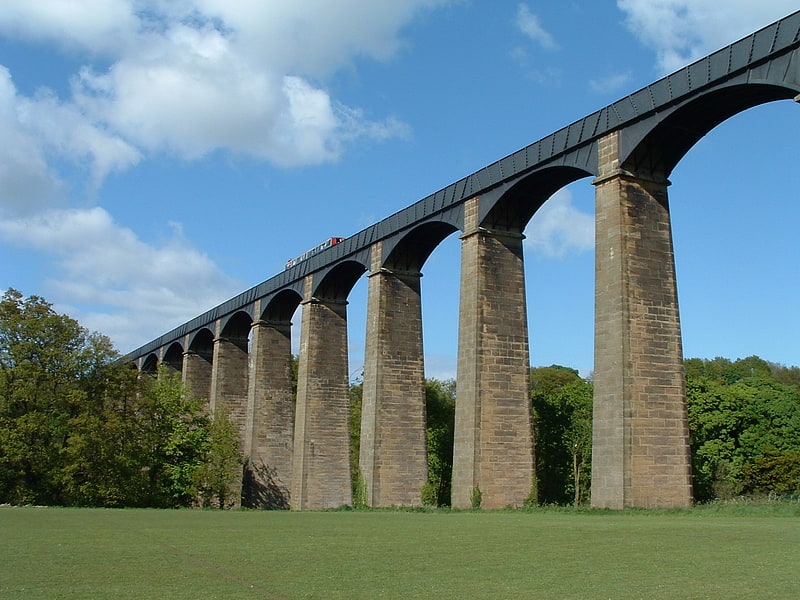
2.7 miN Iconic arched structure with boat ridesPontcysyllte Aqueduct, Llangollen
70 min walk • The Pontcysyllte Aqueduct, a feat of engineering and a testament to the industrial revolution, is a navigable aqueduct located near the town of Llangollen, in the county of Wrexham, Wales. Completed in 1805, this remarkable structure carries the Llangollen Canal over...
 700-year-old Welsh fortress and parkland
Chirk Castle, Chirk
25 min walk • Chirk Castle stands as a majestic testament to medieval military architecture in the small town of Chirk, within the scenic borders of Wales, United Kingdom. Completed in 1310, this imposing fortress has been guarding the entrance to the Ceiriog Valley for over seven...
 Historical place, Garden, Park
Plas Newydd, Llangollen
122 min walk • Plas Newydd is a historic house in the town of Llangollen, Denbighshire, Wales, and was the home of the Ladies of Llangollen, Lady Eleanor Butler and Sarah Ponsonby, for nearly 50 years. Today, it is run as a museum by Denbighshire County Council.
 Canal
CanalTrevor Basin
74 min walk • Trevor Basin is a canal basin on the Llangollen Canal, situated near Trevor, in Clwyd, between Llangollen and Ruabon. The basin was originally built at the northern end of the central section of the Ellesmere Canal, just 150yds north of the Pontcysyllte Aqueduct.
 Bridge
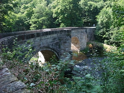
Chirk Aqueduct, Chirk
10 min walk • Chirk Aqueduct is a 70-foot high and 710-foot long navigable aqueduct that carries what is now the Llangollen Canal across the Ceiriog Valley near Chirk, on the England-Wales border, spanning the two countries.
 Forts and castles
Whittington Castle, Oswestry
125 min walk • Whittington Castle is a castle in northern Shropshire, England, owned and managed by the Whittington Castle Preservation Fund. The castle was originally a motte-and-bailey castle, but this was replaced in the 13th century by one with buildings around a courtyard whose exterior wall was the curtain wall of the inner bailey.

 Forts and castles
Old Oswestry
109 min walk • Old Oswestry is a large early Iron Age hill fort in the Welsh Marches near Oswestry in north west Shropshire, England. The earthworks, which remain one of the best preserved hill forts in the UK, have been described as "The Stonehenge of the Iron Age Period".
 Hiking, Hiking trail
Maelor Way
29 min walk • Maelor Way is a key long distance footpath, running 38 kilometres / 24 miles from the Offa's Dyke Path National Trail at Bronygarth to the Shropshire Way, Sandstone Trail, Llangollen Canal, South Cheshire Way, and the Marches Way all at Grindley Brook near Whitchurch.
 Archaeological site
Wat's Dyke, Ruabon
104 min walk • Wat's Dyke is a 40-mile linear earthwork running through the northern Welsh Marches from Basingwerk Abbey on the River Dee estuary, passing east of Oswestry and on to Maesbury in Shropshire, England.
 Bridge
Pont Cysylltau
72 min walk • Pont Cysyllte, also known as Cysylltau Bridge or Bont Bridge, is a 17th-century road bridge crossing the River Dee near the village of Trevor, Wrexham County Borough, Wales. It lies 200 m west of Thomas Telford's Pontcysyllte Aqueduct and, carrying the B5434 road, is the main connection between Trevor and nearby Froncysyllte.