Martinsell Hill
#2738 among destinations in the United Kingdom


Facts and practical information
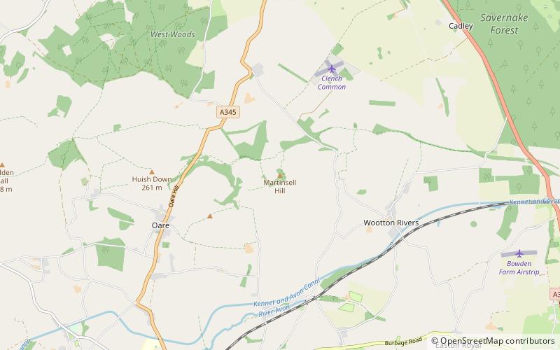
Martinsell Hill, near Oare and north of Pewsey, is the third highest point in the county of Wiltshire, southwest England, at some 289 m / 948 ft above sea level. It is the site of an Iron Age hillfort. ()
EnglandUnited Kingdom
Martinsell Hill – popular in the area (distance from the attraction)
Nearby attractions include: St Mary's Church, Savernake Forest, West Woods, The Sanctuary.
 Church
St Mary's Church, Marlborough
87 min walk • St Mary's Church is the Church of England parish church in the town of Marlborough, Wiltshire, England. The church stands at the east end of the town's High Street.
 Nature, Natural attraction, Forest
Savernake Forest
84 min walk • Savernake Forest stands on a Cretaceous chalk plateau between Marlborough and Great Bedwyn in Wiltshire, England. Its area is approximately 4,500 acres. Most of the forest lies within the civil parish of Savernake.
 Archaeological site
West Woods, Marlborough
53 min walk • West Woods is a wood about 2 ¹⁄₂ miles southwest of the market town of Marlborough in the English county of Wiltshire, United Kingdom. Its area is approximately 957 acres. It is open to the public, and is popular with visitors in the Spring, when bluebells cover the forest floor.
 Archaeological site
The Sanctuary, Avebury
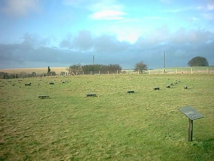
115 min walk • The Sanctuary was a stone and timber circle near the village of Avebury in the south-western English county of Wiltshire. Excavation has revealed the location of the 58 stone sockets and 62 post-holes.
 Canal
CanalBruce Tunnel, Marlborough
93 min walk • The Bruce Tunnel is on the summit pound of the Kennet and Avon Canal between Wootton Top Lock and Crofton Locks in Wiltshire, England. The tunnel is 502 yards long.
 Church
All Saints Church
112 min walk • All Saints Church in Alton Priors, Wiltshire, England, dates from the 12th century. It is recorded in the National Heritage List for England as a designated Grade II* listed building, and is now in the care of The Churches Conservation Trust. It was declared redundant on 28 July 1972, and was vested in the Trust on 12 December 1973.
 Canal
CanalWootton Rivers Lock
37 min walk • Wootton Rivers Lock, also called Wootton Rivers Bottom Lock, is a lock on the Kennet and Avon Canal at Wootton Rivers, Wiltshire, England. Wootton Rivers Bottom Lock was built during the canal's construction between 1794 and 1810. The lock has a rise/fall of 8 ft 0 in.
 Canal
CanalJones's Mill, Pewsey
44 min walk • Jones's Mill is an 11.6 hectare biological Site of Special Scientific Interest near Pewsey in Wiltshire, notified in 1975. The site is managed as a nature reserve by Wiltshire Wildlife Trust.
 Museum, Art gallery
Hill figure, Avebury
113 min walk • A hill figure is a large visual representation created by cutting into a steep hillside and revealing the underlying geology. It is a type of geoglyph usually designed to be seen from afar rather than above. In some cases trenches are dug and rubble made from material brighter than the natural bedrock is placed into them.
 Archaeological site
The Devil's Den, Marlborough
100 min walk • The Devil's Den or Devil's Den is a dolmen burial chamber on Fyfield Hill near Marlborough, Wiltshire, England. The chamber is part of a neolithic passage grave on Fyfield Down.
 Canal
CanalWootton Top Lock
55 min walk • Wootton Top Lock is a lock on the Kennet and Avon Canal at Wootton Rivers, Wiltshire, England. The lock has a rise/fall of 8 ft 0 in. East of this lock is the summit of the canal at 450 ft above sea level. Downstream in the same parish are the locks of Brimslade, Heathy Close, and Wootton Rivers Bottom. It is a Grade II listed structure.
