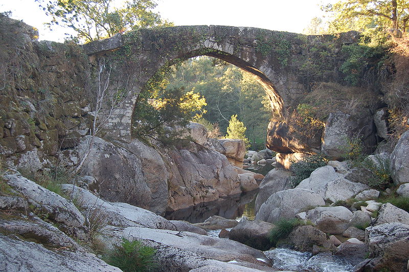
Packhorse bridge

Gallery (2)
Map
Map
Gallery
Facts and practical information
A packhorse bridge is a bridge intended to carry packhorses across a river or stream. Typically a packhorse bridge consists of one or more narrow masonry arches, and has low parapets so as not to interfere with the panniers borne by the horses. Multi-arched examples sometimes have triangular cutwaters that are extended upward to form pedestrian refuges. ()
Coordinates: 52°6'42"N, 0°13'9"W
Day trips