Mill Road, Cambridge
Map

Gallery

Facts and practical information
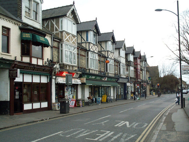
Mill Road is a street in southeast Cambridge, England. It runs southeast from near to Parker's Piece, at the junction with Gonville Place, East Road, and Parkside. It crosses the main railway line and links to the city's ring road. It passes through the wards of Petersfield and Romsey, which are divided by the railway line. It is a busy street containing many independent businesses, churches, a Hindu temple and Cambridge Central Mosque. ()
Coordinates: 52°11'60"N, 0°8'15"E
Address
PetersfieldCambridge
ContactAdd
Social media
Add
Day trips
Mill Road – popular in the area (distance from the attraction)
Nearby attractions include: Parker's Piece, The Grafton, Cambridge University Botanic Garden, St Andrew's Street.
Frequently Asked Questions (FAQ)
Which popular attractions are close to Mill Road?
Nearby attractions include Mill Road Cemetery, Cambridge (2 min walk), Covent Garden, Cambridge (4 min walk), Hughes Hall, Cambridge (6 min walk), Anglia Ruskin University, Cambridge (6 min walk).
How to get to Mill Road by public transport?
The nearest stations to Mill Road:
Bus
Train
Bus
- Gonville Place • Lines: X13 (10 min walk)
- The Busway Parkside • Lines: A, B, D (10 min walk)
Train
- Cambridge (11 min walk)


