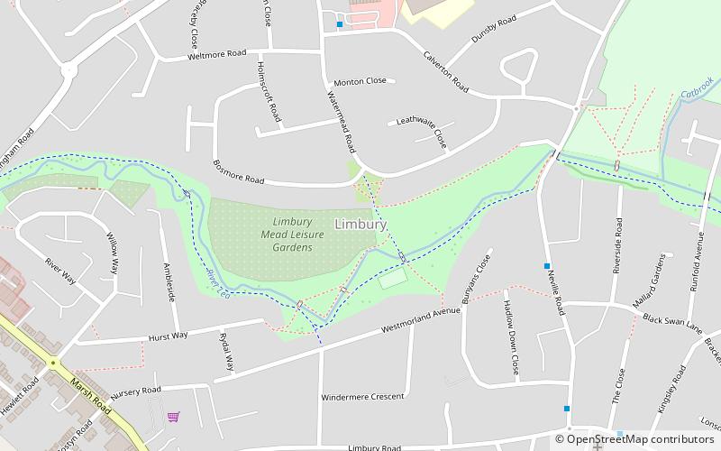
Limbury, Luton
Map
Facts and practical information
Limbury is a suburb of Luton, and was formerly a village in Bedfordshire before Luton expanded around it. The area is roughly bounded by Bramingham Road to the north, Marsh Road to the south, Bramingham Road to the west, and Catsbrook Road, Runfold Avenue, Grosvenor Road, Bancroft Road and Blundell Road to the east. ()
Address
LimburyLuton
ContactAdd
Social media
Add
Getting there by public transportation
Public transportation stops near this location
- Bus
- Train
 Bus
Bus
- Calculate routeLeagrave 13 min walk
- Calculate routeSimpson Close 32 min walk
- Calculate routeHalfway Avenue 33 min walk
Day trips


Frequently Asked Questions (FAQ)
How to get to Limbury by public transport?
The nearest stations to Limbury:
Train
Bus
Train
- Leagrave (13 min walk)
Bus
- Simpson Close • Lines: 737 (32 min walk)
- Halfway Avenue • Lines: 737 (33 min walk)