Geltsdale & Glendue Fells, Geltsdale RSPB reserve
#2 among attractions in Geltsdale RSPB reserve
![Geltsdale & Glendue Fells location map](https://tzmedia.b-cdn.net/media/images/static-maps/gb/54_8833_-2_6.jpg)
Facts and practical information
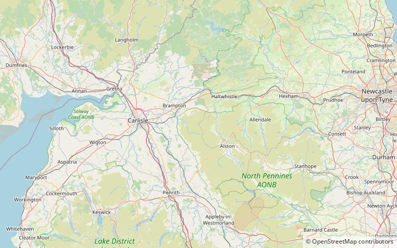
Geltsdale & Glendue Fells is a Site of Special Scientific Interest in the North Pennines, England. The site has an area of 8059 ha, partly in Cumbria and partly in Northumberland. ()
Geltsdale RSPB reserve United Kingdom
Geltsdale RSPB reserve plan & book
Unleash the traveler in you — discover the cheapest flight deals, find the perfect hotel or hostel nearby, and search for the best car rental prices. Travel at your own pace to discover new places and enjoy your journey.
Geltsdale & Glendue Fells – popular in the area (distance from the attraction)
Nearby attractions include: Talkin Tarn, Featherstone Castle, Lambley Viaduct, Geltsdale.
5.1 miNWLake, ParkTalkin Tarn, Carlisle
131 min walk • Talkin Tarn is a glacial lake and country park near Brampton, Cumbria, England. The lake is a kettle hole lake, formed 10,000 years ago by mass glacial action. Situated just 20 minutes from Carlisle by road, or a short train journey via Brampton Junction, this is a popular venue for families and local people.
5.4 miNEForts and castlesFeatherstone Castle, Haltwhistle
138 min walk • Featherstone Castle, a Grade I listed building, is a large Gothic style country mansion situated on the bank of the River South Tyne about 3 miles southwest of the town of Haltwhistle in Northumberland, England.
4.4 miNEBridgeLambley Viaduct
113 min walk • Lambley Viaduct is a stone bridge across the River South Tyne at Lambley in Northumberland. Formerly a railway bridge, it remains open to pedestrians but one end of the viaduct has been fenced off.
2.9 miWProtected areaGeltsdale, North Pennines
74 min walk • Geltsdale is a hamlet and former civil parish, now in the parish of Castle Carrock, in the Carlisle district, in the county of Cumbria, England, to the southeast of Castle Carrock village. In 2001 the parish had a population of 6.
6.1 miSEForts and castlesWhitley Castle, Alston
155 min walk • Whitley Castle is a large, unusually shaped Roman fort north-west of the town of Alston, Cumbria, England. The castrum, which was first built by the Roman Army early in the 2nd century AD, was partly demolished and rebuilt around 200 AD.
6.8 miNWChurch, Gothic Revival architectureSt Martin's Church, Brampton
174 min walk • St Martin's Church is in Front Street, Brampton, Cumbria, England. It is an active Anglican parish church in the deanery of Brampton, the archdeaconry of Carlisle and the diocese of Carlisle.
6.1 miNWForts and castlesNaworth Castle, Hadrian's Wall
157 min walk • Naworth Castle, also known or recorded in historical documents as "Naward", is a castle in Cumbria, England, near the town of Brampton. It is adjacent to the A69, about 2 miles east of Brampton. It is on the opposite side of the River Irthing to, and just within sight of, Lanercost Priory.
7.4 miNEForts and castlesBellister Castle
190 min walk • Bellister Castle is a National Trust owned castellated 19th-century mansion house attached to the ruinous remains of a 14th-century tower house, near Haltwhistle, Northumberland, England. It is a Scheduled Ancient Monument and a Grade I listed building.
4.1 miEBridgeEals Bridge
105 min walk • Eals Bridge is a stone bridge across the River South Tyne near Knarsdale in Northumberland.
4.4 miNEBridgeLambley Footbridge
112 min walk • Lambley Footbridge is a wooden bridge across the River South Tyne at Lambley in Northumberland.
5.9 miNEBridgeFeatherstone Bridge
151 min walk • Featherstone Bridge is a stone arch bridge across the River South Tyne at Featherstone in Northumberland.