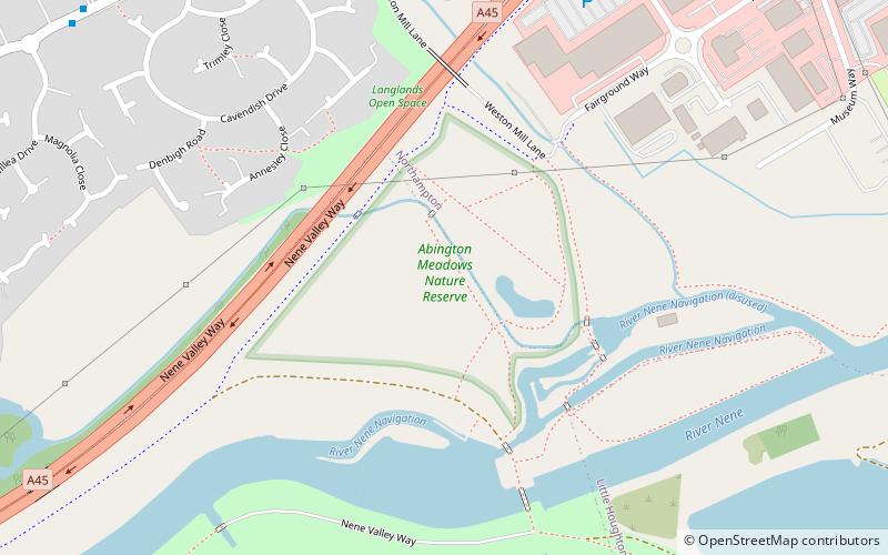
Abington Meadows, Northampton

Gallery (1)
Map
Map
Facts and practical information
Abington Meadows is a 9.6 hectare nature reserve in Northampton. It is owned by Northamptonshire County Council and managed by the Wildlife Trust for Bedfordshire, Cambridgeshire and Northamptonshire. ()
Area: 23.72 acres (0.0371 mi²)Elevation: 167 ft a.s.l.Coordinates: 52°14'19"N, 0°50'36"W
Address
RushmillsNorthampton
ContactAdd
Social media
Add
Day trips