Cathcart Castle, Glasgow
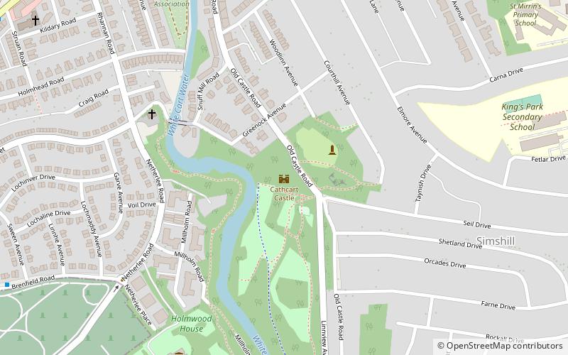
Map
Facts and practical information
Cathcart Castle was a 15th-century castle, located in what is now Linn Park in the Cathcart area of southern Glasgow, Scotland. The castle was abandoned in the 18th century, and the remaining ruins were pulled down in 1980, leaving only foundations visible. ()
Getting there by public transportation
Public transportation stops near this location
- Bus
- Train
 Bus
Bus
- Calculate routeCathcart 10 min walk
- Calculate routeKings Park 16 min walk
- Calculate routeMuirend 19 min walk
- Calculate routeMount Florida 25 min walk
- Calculate routeCarmunnock Road / Croftfoot Road 12 min walk
- Calculate routeCroftpark Avenue / Croftburn Drive 16 min walk
- Calculate routeCroftfoot Road / Croftburn Drive 17 min walk
Day trips


Frequently Asked Questions (FAQ)
Which popular attractions are close to Cathcart Castle?
Nearby attractions include Holmwood House, Glasgow (6 min walk), Simshill, Glasgow (7 min walk), Cathcart Old Church, Glasgow (10 min walk), Couper Institute Library, Glasgow (11 min walk).
How to get to Cathcart Castle by public transport?
The nearest stations to Cathcart Castle:
Train
Bus
Train
- Cathcart (10 min walk)
- Kings Park (16 min walk)
Bus
- Carmunnock Road / Croftfoot Road • Lines: M2 (12 min walk)
- Croftpark Avenue / Croftburn Drive • Lines: M2 (16 min walk)