Hayes Lane, London

Gallery (1)
Map
Map
Facts and practical information
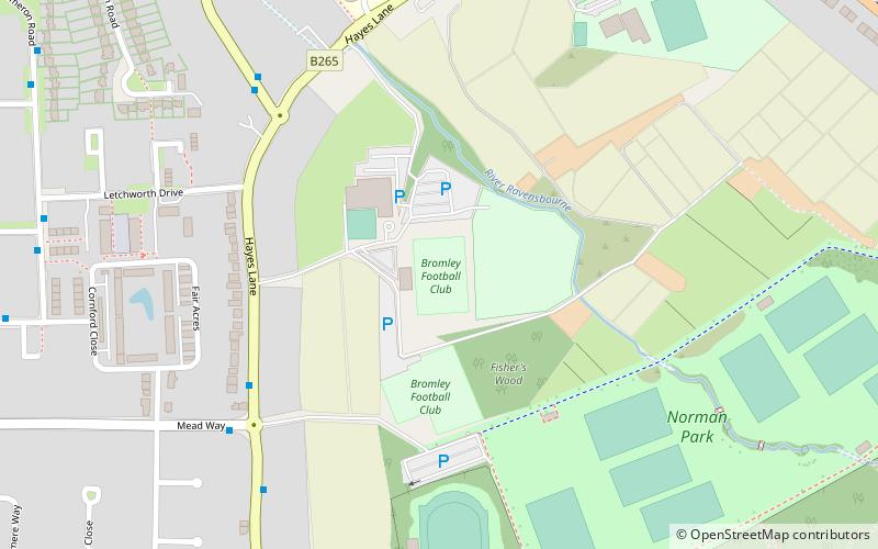
Hayes Lane is a football stadium in Bromley, Greater London, England. Located between Bromley town centre and Hayes, it is the home of Bromley F.C. and also used by Cray Wanderers and Crystal Palace Women. ()
Opened: 1938 (88 years ago)Capacity: 5000Coordinates: 51°23'24"N, 0°1'16"E
Address
Bromley (Hayes and Coney Hall)London
ContactAdd
Social media
Add
Getting there by public transportation
Public transportation stops near this location
- Bus
- Train
 Bus
Bus
- Calculate routeHayes Lane / Norman Park 6 min walk
- Calculate routeMead Way / Norman Park 6 min walk
- Calculate routeHayes Road / Hayes Lane 6 min walk
- Calculate routeCheriton Avenue 9 min walk
- Calculate routeBromley South 18 min walk
- Calculate routeHayes 27 min walk
- Calculate routeBickley 31 min walk
- Calculate routeShortlands 35 min walk
Maps Tube
Tube
TubeDay trips


Frequently Asked Questions (FAQ)
How to get to Hayes Lane by public transport?
The nearest stations to Hayes Lane:
Bus
Train
Bus
- Hayes Lane / Norman Park • Lines: 119, 146, 314 (6 min walk)
- Mead Way / Norman Park • Lines: 314 (6 min walk)
Train
- Bromley South (18 min walk)
- Hayes (27 min walk)