St Alban's Church, Havant
Map
Facts and practical information
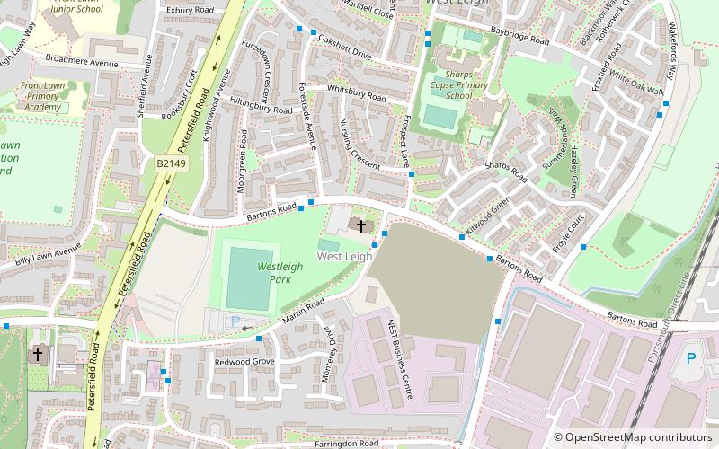
St Alban's Church is a Church of England parish church situated in West Leigh, Hampshire, England. ()
Coordinates: 50°52'4"N, 0°58'17"W
Address
Bartons RoadHavant
ContactAdd
Social media
Add
Getting there by public transportation
Public transportation stops near this location
- Bus
- Train
 Bus
Bus
- Calculate routeWarblington 26 min walk
- Calculate routeHavant 27 min walk
- Calculate routeBedhampton 37 min walk
- Calculate routeHavant Bus Station 31 min walk
Day trips


Frequently Asked Questions (FAQ)
Which popular attractions are close to St Alban's Church?
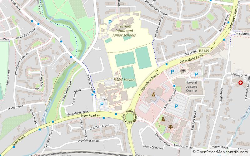
Nearby attractions include Leigh Park Gardens, Havant (11 min walk), Park Parade, Havant (15 min walk), Denvilles, Havant (23 min walk), Havant and South Downs College, Havant (24 min walk).
How to get to St Alban's Church by public transport?
The nearest stations to St Alban's Church:
Train
Bus
Train
- Warblington (26 min walk)
- Havant (27 min walk)
Bus
- Havant Bus Station (31 min walk)