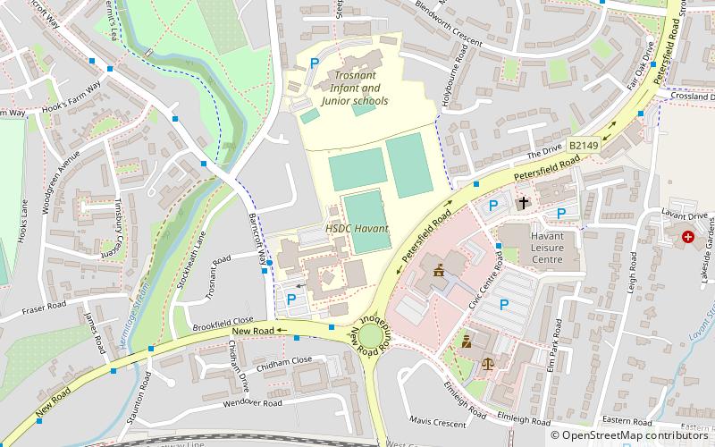
Havant and South Downs College, Havant
Map
Facts and practical information
HSDC is a Further education college located in Waterlooville, Hampshire, England. The college was formed on 1 August 2017 following a merger of South Downs College and Havant Sixth Form College. ()
Coordinates: 50°51'30"N, 0°59'11"W
Getting there by public transportation
Public transportation stops near this location
- Bus
- Train
 Bus
Bus
- Calculate routeHavant 9 min walk
- Calculate routeBedhampton 14 min walk
- Calculate routeWarblington 23 min walk
- Calculate routeHavant Bus Station 11 min walk
Day trips


Frequently Asked Questions (FAQ)
Which popular attractions are close to Havant and South Downs College?
Nearby attractions include Park Parade, Havant (15 min walk), Denvilles, Havant (23 min walk), St Alban's Church, Havant (24 min walk).
How to get to Havant and South Downs College by public transport?
The nearest stations to Havant and South Downs College:
Train
Bus
Train
- Havant (9 min walk)
- Bedhampton (14 min walk)
Bus
- Havant Bus Station (11 min walk)