Loch Neldricken, Silver Flowe-Merrick Kells

Gallery (1)
Map
Map
Facts and practical information
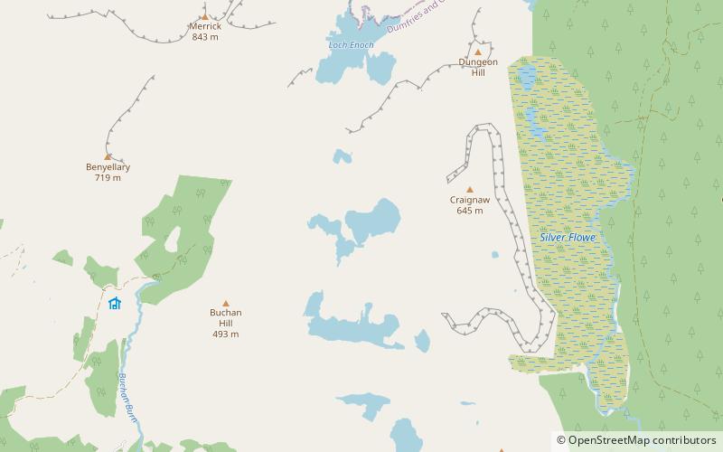
Loch Neldricken is a loch in Galloway to the south-east of Merrick, south of Craig Neldricken and west of Craignaw. The loch is almost bisected by a long promontory. It drains via the short Mid Burn into Loch Valley and then via Gairland Burn down to Loch Trool. ()
Elevation: 1152 ft a.s.l.Coordinates: 55°6'60"N, 4°26'20"W
Address
Silver Flowe-Merrick Kells
ContactAdd
Social media
Add
Day trips


Frequently Asked Questions (FAQ)
Which popular attractions are close to Loch Neldricken?
Nearby attractions include Galloway Forest Park, Silver Flowe-Merrick Kells (20 min walk), Loch Valley, Silver Flowe-Merrick Kells (22 min walk), Craignaw, Silver Flowe-Merrick Kells (22 min walk).