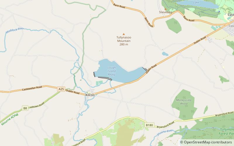
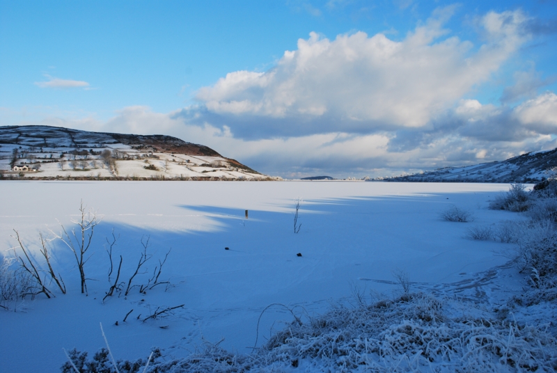
Lough Island Reavy
#5085 among destinations in the United Kingdom
![Lough Island Reavy location map](https://tzmedia.b-cdn.net/media/images/static-maps/gb/54_2389_-6_01389.jpg)
![Lough Island Reavy](https://tzmedia.b-cdn.net/media/images/gb/place/gallery/medium/4c5b75b9ab6050cdcdbb25f6fdb263a6.jpg)
Facts and practical information
Lough Island Reavy is a small man-made lough in Kilcoo, County Down, Northern Ireland. It is a fishing spot, which is controlled by the Belfast Anglers club. The lake contains pike and perch, as well as small numbers of wild brown trout and eels. ()
Northern IrelandUnited Kingdom
Lough Island Reavy plan & book
Unleash the traveler in you — discover the cheapest flight deals, find the perfect hotel or hostel nearby, and search for the best car rental prices. Travel at your own pace to discover new places and enjoy your journey.
Lough Island Reavy – popular in the area (distance from the attraction)
Nearby attractions include: Tide pool, Tollymore Forest Park, Slieve Donard, Slieve Commedagh.
5.5 miSEWatersports, Swimming poolTide pool, Newcastle
141 min walk • A tide pool or rock pool is a shallow pool of seawater that forms on the rocky intertidal shore. Many of these pools exist as separate bodies of water only at low tide.
3.1 miSEParkTollymore Forest Park
79 min walk • Nestled in the heart of County Down, Northern Ireland, Tollymore Forest Park is an enchanting expanse of woodland that offers a natural retreat for visitors looking to immerse themselves in the beauty of the great outdoors.
5.5 miSENorthern Ireland's highest peakSlieve Donard
141 min walk • Slieve Donard is the highest mountain in Northern Ireland and the wider province of Ulster, with a height of 850 metres. The highest of the Mourne Mountains, it is near the town of Newcastle on the eastern coast of County Down, overlooking the Irish Sea.
4.6 miSENature, Natural attraction, MountainSlieve Commedagh
118 min walk • Slieve Commedagh is a mountain with a height of 767 m in County Down, Northern Ireland. It is the second-highest of the Mourne Mountains, after Slieve Donard, and the second-highest mountain in Northern Ireland.
2.8 miNEParkCastlewellan Forest Park
72 min walk • Castlewellan Forest Park is located in the town of Castlewellan in County Down, Northern Ireland. The park covers some 460 hectares, including woodland and a 40 hectare lake.
3.9 miSNature, Natural attraction, MountainSlieve Bearnagh
99 min walk • Slieve Bearnagh is one of the Mourne Mountains in County Down, Northern Ireland. It has a height of 739 metres. Its summit is crowned by two tors with a gap between them, giving it a distinctive shape.
5.2 miSEParkDonard Park, Newcastle
133 min walk • Donard Park is a public park located in Newcastle, County Down, Northern Ireland. It is next to the Glen River, which forms the boundary along one side and is at the foot of Slieve Donard, the highest mountain in Northern Ireland, part of the Mourne Mountains.
3.8 miSNature, Natural attraction, MountainSlieve Meelbeg
98 min walk • Slieve Meelbeg is a mountain located in the Mourne Mountains. It is a popular hiking destination and is 5.5 miles east of the village of Hilltown.
5.2 miSENature, Natural attraction, ForestDonard Forest
132 min walk • Donard Forest is located near Newcastle, County Down, Northern Ireland. It borders Donard Park at the foot of the Mourne Mountains. The Glen River flows through the forest where it is crossed by three stone bridges. The north east section of the forest contains a Heritage Stand of Scots and Corsican pine planted in 1927.
5.1 miSNature, Natural attraction, CliffBen Crom
131 min walk • Ben Crom is a 526 metres mountain in the Mourne Mountains in County Down, Northern Ireland. It is situated beside Ben Crom Reservoir, which is upstream from Silent Valley Reservoir. The mountain is composed of granite.
3.8 miSNature, Natural attraction, MountainSlieve Muck
98 min walk • Slieve Muck is one of the Mourne Mountains in County Down, Northern Ireland. It has a height of 670.4 metres. The River Bann has its source on the northern slope.