St Helens College, St Helens
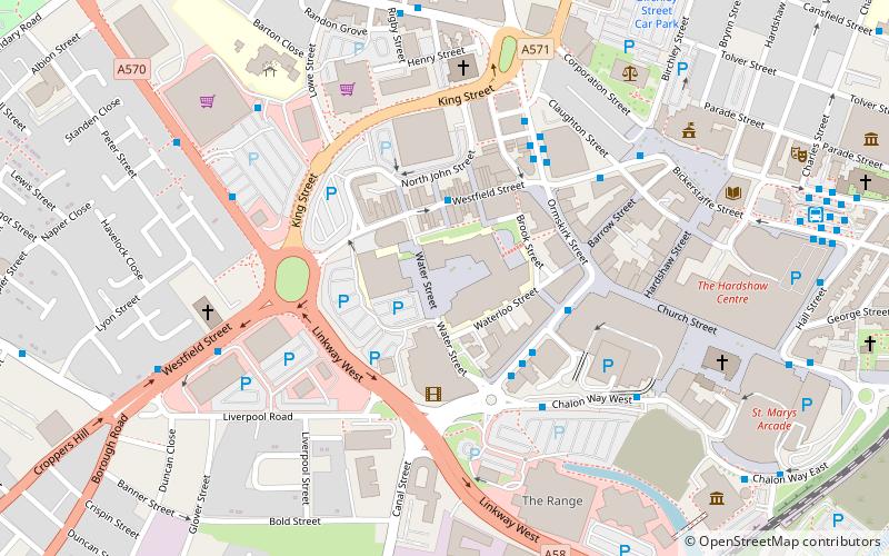
Map
Facts and practical information
St Helens College is a further education college serving the borough of St Helens In 2009/10 it had 2,193 full-time adult learners aged 16–18 plus another 585 part-time learners. It had 541 full-time adult learners, plus another 3,215 part-time adult learners. The total number of enrolments in 2009/10, including 14-16, FE, foundation learning, entry to employment, adult learners, and apprenticeships was 11,408 benefit claimants. ()
Coordinates: 53°27'9"N, 2°44'25"W
Getting there by public transportation
Public transportation stops near this location
- Bus
- Train
 Bus
Bus
- Calculate routeSt Helens Bus Station 8 min walk
- Calculate routeCorporation St/St Helens Central 11 min walk
- Calculate routeSt Helens Central 11 min walk
- Calculate routeThatto Heath 35 min walk
Day trips


Frequently Asked Questions (FAQ)
Which popular attractions are close to St Helens College?
Nearby attractions include The Citadel, St Helens (2 min walk), Statue of Queen Victoria, St Helens (6 min walk), St Helens Town Hall, St Helens (6 min walk), Church of St Helen, St Helens (6 min walk).
How to get to St Helens College by public transport?
The nearest stations to St Helens College:
Bus
Train
Bus
- St Helens Bus Station (8 min walk)
- Corporation St/St Helens Central • Lines: 329 (11 min walk)
Train
- St Helens Central (11 min walk)
- Thatto Heath (35 min walk)