Union Mills
#3657 among destinations in the United Kingdom
![Union Mills location map](https://tzmedia.b-cdn.net/media/images/static-maps/gb/52_9597_0_73472.jpg)
Facts and practical information
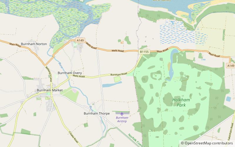
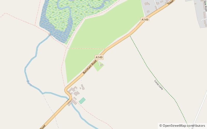
Union Mills or Roy's Mills are a Grade II listed combined tower mill and watermill at Burnham Overy, Norfolk, England which has been converted to residential accommodation. ()
EnglandUnited Kingdom
Union Mills plan & book
Unleash the traveler in you — discover the cheapest flight deals, find the perfect hotel or hostel nearby, and search for the best car rental prices. Travel at your own pace to discover new places and enjoy your journey.
Union Mills – popular in the area (distance from the attraction)
Nearby attractions include: Royal West Norfolk Golf Club, Holkham Hall, Basilica of Our Lady of Walsingham, Titchwell Marsh.
3.5 miWGolfRoyal West Norfolk Golf Club, North Norfolk Coast Site of Special Scientific Interest
89 min walk • Royal West Norfolk Golf Club is a golf club in Brancaster, Norfolk, England, about 7 miles east of Hunstanton, between Brancaster Bay and the salt marshes. The links course opened in 1892. Simon Rayner is a professional at the club.
3.1 miEPalladian country house attractionHolkham Hall, Wells-next-the-Sea
79 min walk • Holkham Hall is an 18th-century country house near the village of Holkham, Norfolk, England, constructed in the Neo-Palladian style for the 1st Earl of Leicester, by the architect William Kent, aided by Lord Burlington.
7.3 miSEChurchBasilica of Our Lady of Walsingham
188 min walk • The Basilica of Our Lady of Walsingham, informally known as the Slipper Chapel or the Chapel of Saint Catherine of Alexandria, is a Roman Catholic basilica in Houghton Saint Giles, Norfolk, England.
5.4 miWProtected areaTitchwell Marsh, Norfolk Coast AONB
139 min walk • Titchwell Marsh is an English nature reserve owned and managed by the Royal Society for the Protection of Birds.
~0 ftNWindmillBurnham Overy Staithe Windmill, Norfolk Coast AONB
1 min walk • Burnham Overy Staithe Windmill is a Grade II* listed building tower mill at Burnham Overy Staithe, Norfolk, England which has been converted to holiday accommodation.
1.9 miNWAreaScolt Head Island, North Norfolk Coast Site of Special Scientific Interest
50 min walk • Scolt Head Island is an offshore barrier island between Brancaster and Wells-next-the-Sea in north Norfolk. It is in the parish of Burnham Norton and is accessed by a seasonal ferry from the village of Overy Staithe.
2.9 miSMonasteryCreake Abbey
74 min walk • Creake Abbey is a ruined abbey in Norfolk, England, situated alongside the River Burn and a mile to the north of the village of North Creake. The abbey church was dedicated to Saint Mary. The ruins are Grade I listed, and form part of a Scheduled Monument site.
3.4 miWForts and castlesBranodunum
88 min walk • Branodunum was an ancient Roman fort to the east of the modern English village of Brancaster in Norfolk. Its Roman name derives from the local Celtic language, and may mean "fort of the raven".
1.5 miEMonasteryPeterstone Priory, Norfolk Coast AONB
40 min walk • Peterstone Priory a house of Augustinian Canons, was a priory in Burnham Overy, Norfolk, England. It was founded before 1200 and incorporated 1449.
4 miWLocalityBrancaster
102 min walk • Brancaster is a village and civil parish on the north coast of the English county of Norfolk. The civil parish of Brancaster comprises Brancaster itself, together with Brancaster Staithe and Burnham Deepdale.
2.3 miEForts and castlesHolkham Camp, Holkham National Nature Reserve
60 min walk • Holkham Camp, or Holkham Fort, is an Iron Age fort in Norfolk, England, about 1 mile north-west of the village of Holkham. It is a scheduled monument.