Batsford Road, Cotswold Water Park
Map
Facts and practical information
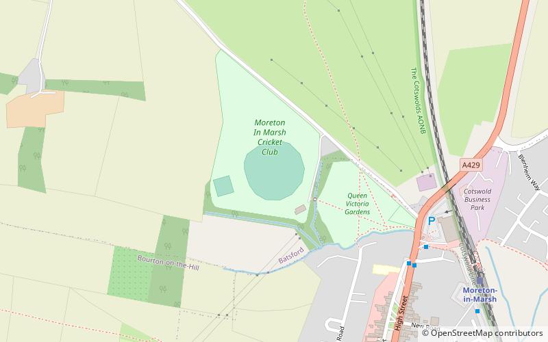
Batsford Road, sometimes known as Moreton-in-Marsh Cricket Club Ground, is a cricket ground in Moreton-in-Marsh, Gloucestershire. The ground is located off the Batsford Road as it leaves Moreton-in-Marsh. It played host to first-class and List A cricket matches for Gloucestershire County Cricket Club between 1884 and 1996. ()
Coordinates: 51°59'39"N, 1°42'24"W
Address
Cotswold Water Park
ContactAdd
Social media
Add
Getting there by public transportation
Public transportation stops near this location
- Train
 Train
Train
- Calculate routeMoreton-in-Marsh 8 min walk
Day trips


Frequently Asked Questions (FAQ)
How to get to Batsford Road by public transport?
The nearest stations to Batsford Road:
Train
Train
- Moreton-in-Marsh (8 min walk)