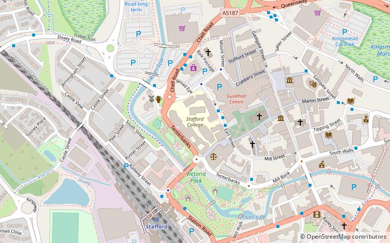
Stafford College, Stafford
Map
Facts and practical information
Stafford College is a large provider of further and higher education based in Stafford, England. ()
Coordinates: 52°48'22"N, 2°7'15"W
Getting there by public transportation
Public transportation stops near this location
- Bus
- Train
 Bus
Bus
- Calculate routeGuildhall Shopping Centre 2 min walk
- Calculate routeChell Road 3 min walk
- Calculate routeMill Bank 4 min walk
- Calculate routeStafford 5 min walk
Day trips


Frequently Asked Questions (FAQ)
Which popular attractions are close to Stafford College?
Nearby attractions include Broad Eye Windmill, Stafford (3 min walk), St Mary's Church, Stafford (3 min walk), Ancient High House, Stafford (5 min walk), Shire Hall, Stafford (5 min walk).
How to get to Stafford College by public transport?
The nearest stations to Stafford College:
Bus
Train
Bus
- Guildhall Shopping Centre • Lines: 877, 878 (2 min walk)
- Chell Road • Lines: 877, 878 (3 min walk)
Train
- Stafford (5 min walk)