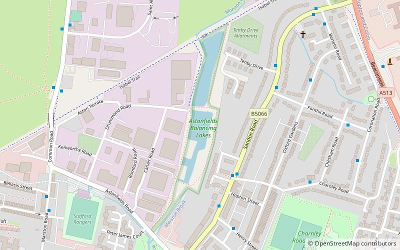
Astonfields Balancing Lakes, Stafford
Map
Facts and practical information
Astonfields Balancing Lakes is a local nature reserve on the north-eastern edge of Stafford, in Staffordshire, England. ()
Elevation: 269 ft a.s.l.Coordinates: 52°49'16"N, 2°6'42"W
Address
Astonfields Industrial Estate, Drummond RdStafford
ContactAdd
Social media
Add
Getting there by public transportation
Public transportation stops near this location
- Bus
 Bus
Bus
- Calculate routeGaol Square Bus Station 22 min walk
- Calculate routeGaol Square 22 min walk
- Calculate routeGatehouse Theatre 25 min walk
- Calculate routeShrewsbury Arms PH 26 min walk
Day trips


Frequently Asked Questions (FAQ)
How to get to Astonfields Balancing Lakes by public transport?
The nearest stations to Astonfields Balancing Lakes:
Bus
Bus
- Gaol Square Bus Station (22 min walk)
- Gaol Square • Lines: 877, 878 (22 min walk)