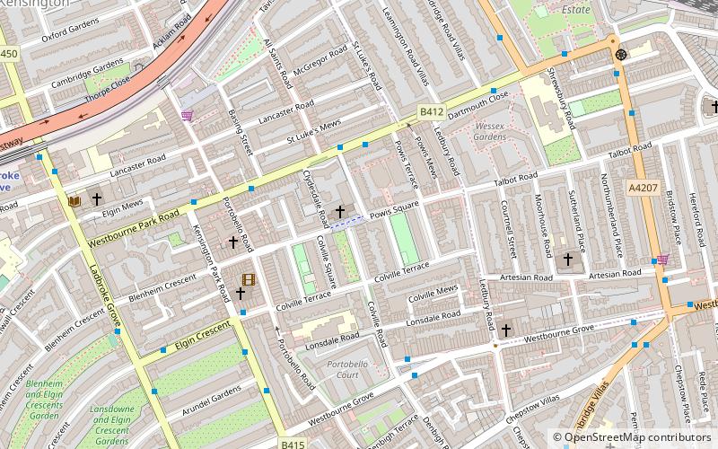
All Saints Notting Hill, London
Map
Facts and practical information
All Saints Notting Hill is a Church of England parish church in Talbot Road, Notting Hill, London. It is a Victorian Gothic Revival stone building with polychromatic decoration. The west tower has five stages with the stump of a spire, and the chancel has paintings by Henry Holiday. ()
Architectural style: Gothic revivalCoordinates: 51°30'59"N, 0°12'9"W
Address
Kensington and Chelsea (Colville)London
ContactAdd
Social media
Add
Getting there by public transportation
Public transportation stops near this location
- Metro
- Bus
- Train
 Metro
Metro
- Calculate routePowis Gardens 3 min walk
- Calculate routePortobello Road 4 min walk
- Calculate routeWestbourne Grove / Colville Road 4 min walk
- Calculate routeColville Road 5 min walk
- Calculate routeLadbroke Grove 10 min walk
- Calculate routeNotting Hill Gate 15 min walk
- Calculate routeHolland Park 17 min walk
- Calculate routeBayswater 18 min walk
- Calculate routeShepherd's Bush 26 min walk
- Calculate routeLondon Paddington 28 min walk
Maps Tube
Tube
TubeDay trips


Frequently Asked Questions (FAQ)
Which popular attractions are close to All Saints Notting Hill?
Nearby attractions include Portobello Road, London (4 min walk), Arundel Gardens, London (6 min walk), St Peter's, London (7 min walk), Museum of Brands, London (10 min walk).
How to get to All Saints Notting Hill by public transport?
The nearest stations to All Saints Notting Hill:
Bus
Metro
Train
Bus
- Powis Gardens • Lines: 7, 70, N7 (3 min walk)
- Portobello Road • Lines: 23, 7, 70, N7 (4 min walk)
Metro
- Ladbroke Grove • Lines: Circle, Hammersmith & City (10 min walk)
- Notting Hill Gate • Lines: Central, Circle, District (15 min walk)
Train
- Shepherd's Bush (26 min walk)
- London Paddington (28 min walk)