The Railway, Altrincham
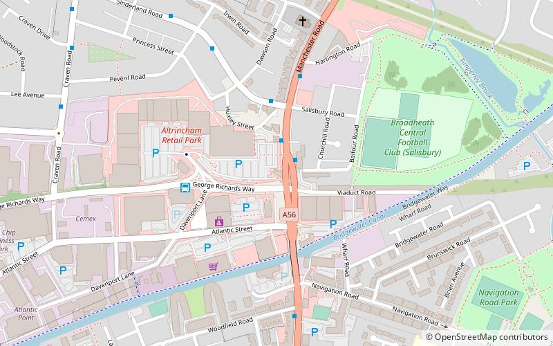
Map
Facts and practical information
The Railway is a Grade II listed public house at 153 Manchester Road, Broadheath, Altrincham, Greater Manchester WA14 5NT. ()
Coordinates: 53°23'59"N, 2°21'10"W
Address
Trafford (Broadheath)Altrincham
ContactAdd
Social media
Add
Getting there by public transportation
Public transportation stops near this location
- Bus
- Tram
- Train
 Bus
Bus
- Calculate routeDavenport Lane 4 min walk
- Calculate routeGaskell Road/Barrington Road 13 min walk
- Calculate routeEllesmere Road/Ashton Avenue 13 min walk
- Calculate routeNavigation Road Tram Stop 14 min walk
- Calculate routeNavigation Road 13 min walk
- Calculate routeTimperley 18 min walk
- Calculate routeAltrincham 23 min walk
- Calculate routeNavigation Road 13 min walk
- Calculate routeAltrincham 23 min walk
Day trips


Frequently Asked Questions (FAQ)
Which popular attractions are close to The Railway?
Nearby attractions include St Alban's Church, Altrincham (6 min walk), Trafford College, Altrincham (11 min walk), Brook Lane Garden Nursery, Altrincham (14 min walk), St George's Church, Altrincham (17 min walk).
How to get to The Railway by public transport?
The nearest stations to The Railway:
Bus
Tram
Train
Bus
- Davenport Lane (4 min walk)
- Gaskell Road/Barrington Road • Lines: 20 (13 min walk)
Tram
- Navigation Road • Lines: Altr, Bury, Picc (13 min walk)
- Timperley • Lines: Altr, Bury, Picc (18 min walk)
Train
- Navigation Road (13 min walk)
- Altrincham (23 min walk)