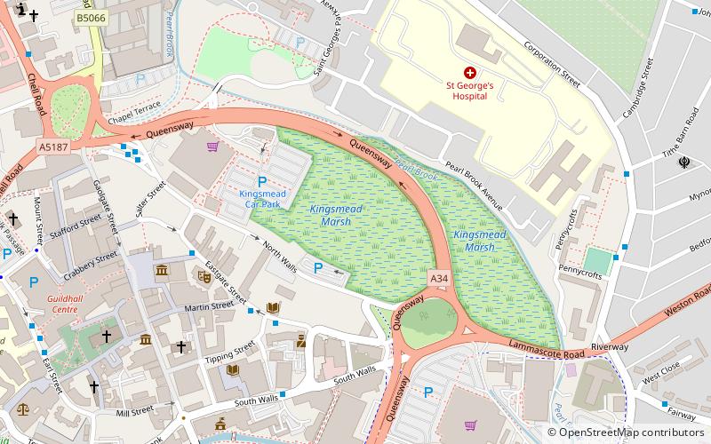
Kingsmead Marsh, Stafford
Map
Facts and practical information
Kingsmead Marsh is a local nature reserve near Stafford, in Staffordshire, England. Its area is about 6 hectares, and it is designated a Grade 1 Site of Biological Importance. ()
Elevation: 256 ft a.s.l.Coordinates: 52°48'29"N, 2°6'44"W
Getting there by public transportation
Public transportation stops near this location
- Bus
- Train
 Bus
Bus
- Calculate routeShrewsbury Arms PH 4 min walk
- Calculate routeGatehouse Theatre 5 min walk
- Calculate routeCope Street 5 min walk
- Calculate routeGaol Square 7 min walk
- Calculate routeStafford 14 min walk
Day trips
Kingsmead Marsh – popular in the area (distance from the attraction)
Nearby attractions include: St Mary's Church, Shire Hall, St Chad's Church, Stafford Castle Golf Club.


Frequently Asked Questions (FAQ)
Which popular attractions are close to Kingsmead Marsh?
Nearby attractions include William Salt Library, Stafford (4 min walk), Gatehouse Theatre, Stafford (5 min walk), Borough Hall, Stafford (5 min walk), Shire Hall, Stafford (6 min walk).
How to get to Kingsmead Marsh by public transport?
The nearest stations to Kingsmead Marsh:
Bus
Train
Bus
- Shrewsbury Arms PH • Lines: 877, 878 (4 min walk)
- Gatehouse Theatre • Lines: 877, 878 (5 min walk)
Train
- Stafford (14 min walk)