Spa Road, Gloucester

Gallery (3)
Map
Map
Gallery
Facts and practical information
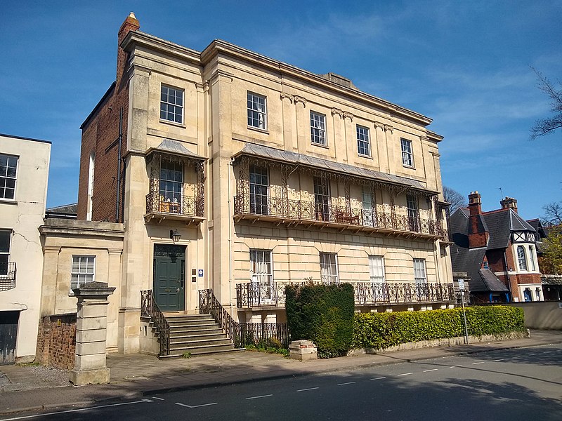
Spa Road in the City of Gloucester runs between the junction of Southgate Street and Llanthony Road in the north and Montpellier in the South. It is joined by Brunswick Road on its north side. It contains a number of listed buildings. ()
Coordinates: 51°51'36"N, 2°14'53"W
Address
Gloucester
ContactAdd
Social media
Add
Getting there by public transportation
Public transportation stops near this location
- Train
 Train
Train
- Calculate routeGloucester 15 min walk
Day trips
Spa Road – popular in the area (distance from the attraction)
Nearby attractions include: Eastgate Shopping Centre, Kings Walk Shopping Centre, Gloucester Quays Outlet, Gloucester Waterways Museum.


Frequently Asked Questions (FAQ)
Which popular attractions are close to Spa Road?
Nearby attractions include Gloucester First Spiritualist Church, Gloucester (3 min walk), Gloucester National Spiritualist Church, Gloucester (3 min walk), Gloucester Waterways Museum, Gloucester (7 min walk), St Kyneburgh's Chapel, Gloucester (7 min walk).
How to get to Spa Road by public transport?
The nearest stations to Spa Road:
Train
Train
- Gloucester (15 min walk)