Port of Garston, Liverpool
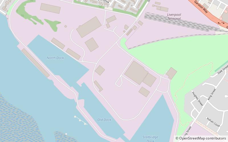
Map
Facts and practical information
The Port of Garston, also known as Garston Docks is an enclosed tidal dock system on the River Mersey at Garston, approx 6 miles from Liverpool City centre Liverpool, England. It is operated by Associated British Ports ()
Coordinates: 53°21'4"N, 2°54'25"W
Address
Speke-GarstonLiverpool
ContactAdd
Social media
Add
Getting there by public transportation
Public transportation stops near this location
- Bus
- Train
 Bus
Bus
- Calculate routeCressington 15 min walk
- Calculate routeLiverpool South Parkway 23 min walk
- Calculate routeAigburth 32 min walk
- Calculate routeLiverpool South Parkway 22 min walk
Day trips


Frequently Asked Questions (FAQ)
Which popular attractions are close to Port of Garston?
Nearby attractions include St Michael's Church, Liverpool (11 min walk), Garston, Liverpool (12 min walk), St Mary's Church, Liverpool (16 min walk), St Austin's Church, Liverpool (20 min walk).
How to get to Port of Garston by public transport?
The nearest stations to Port of Garston:
Train
Bus
Train
- Cressington (15 min walk)
- Liverpool South Parkway (23 min walk)
Bus
- Liverpool South Parkway (22 min walk)