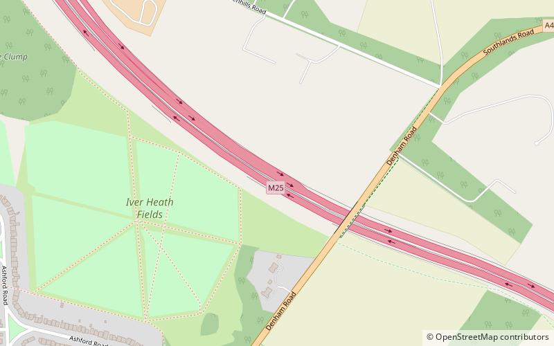
M25 motorway, Uxbridge
Map
Facts and practical information
The M25 or London Orbital Motorway is a major road encircling most of Greater London. The 117-mile motorway is one of the most important roads in the UK and one of the busiest. Margaret Thatcher opened the final section in 1986, making the M25 the longest ring road in Europe upon opening. The Dartford Crossing completes the orbital route but is not classed as motorway; it is classed as a trunk road and designated as the A282. In some cases, such as the Communications Act 2003, the M25 is used as a de facto reference to Greater London. ()
Address
Uxbridge
ContactAdd
Social media
Add
Getting there by public transportation
Public transportation stops near this location
- Bus
 Bus
Bus
- Calculate routeThe Black Horse 20 min walk
- Calculate routeSlough Road 26 min walk
Day trips


Frequently Asked Questions (FAQ)
How to get to M25 motorway by public transport?
The nearest stations to M25 motorway:
Bus
Bus
- The Black Horse • Lines: 583 (20 min walk)
- Slough Road • Lines: 3 (26 min walk)