Ashford Community Woodland, Ashford
Map
Facts and practical information
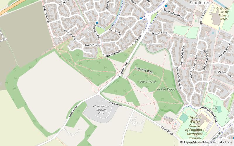
Ashford Community Woodland is a 13.8-hectare Local Nature Reserve on the western outskirts of Ashford in Kent. It is owned and managed by Ashford Borough Council. ()
Elevation: 213 ft a.s.l.Coordinates: 51°8'10"N, 0°50'2"E
Address
Ashford
ContactAdd
Social media
Add
Getting there by public transportation
Public transportation stops near this location
- Bus
 Bus
Bus
- Calculate routeQueens Head 41 min walk
Day trips


Frequently Asked Questions (FAQ)
How to get to Ashford Community Woodland by public transport?
The nearest stations to Ashford Community Woodland:
Bus
Bus
- Queens Head • Lines: 2A (41 min walk)