El Vino, London
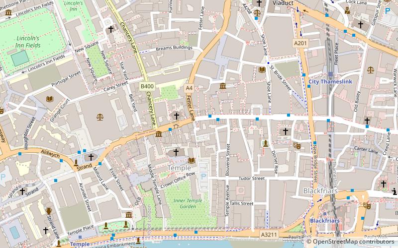
Map
Facts and practical information
El Vino, also known as El Vino's, is a wine bar and off-licence in Fleet Street that was famously patronised by journalists when many national newspapers were based nearby. ()
Coordinates: 51°30'50"N, 0°6'33"W
Address
47 Fleet StreetCity of London (Farringdon Without)London
Contact
+44 20 7353 6786
Social media
Add
Getting there by public transportation
Public transportation stops near this location
- Metro
- Bus
- Light rail
- Train
- Ferry
 Metro
Metro
- Calculate routeFetter Lane 1 min walk
- Calculate routeChancery Lane 2 min walk
- Calculate routeShoe Lane 3 min walk
- Calculate routeLudgate Circus 5 min walk
- Calculate routeCity Thameslink 7 min walk
- Calculate routeLondon Blackfriars 9 min walk
- Calculate routeWaterloo East 18 min walk
- Calculate routeCharing Cross 20 min walk
- Calculate routeTemple 8 min walk
- Calculate routeChancery Lane 9 min walk
- Calculate routeSt. Paul's 12 min walk
- Calculate routeFarringdon 13 min walk
- Calculate routeBlackfriars Pier 11 min walk
- Calculate routeFestival Pier 16 min walk
- Calculate routeBankside Pier 17 min walk
- Calculate routeEmbankment 19 min walk
- Calculate routeBank Platform 10 24 min walk
Maps Tube
Tube
TubeDay trips


Frequently Asked Questions (FAQ)
Which popular attractions are close to El Vino?
Nearby attractions include St Dunstan-in-the-West, London (1 min walk), Dr Johnson's House, London (2 min walk), Temple Church, London (3 min walk), Temple, London (3 min walk).
How to get to El Vino by public transport?
The nearest stations to El Vino:
Bus
Train
Metro
Ferry
Light rail
Bus
- Fetter Lane • Lines: 26, N26 (1 min walk)
- Chancery Lane • Lines: 26, N26 (2 min walk)
Train
- City Thameslink (7 min walk)
- London Blackfriars (9 min walk)
Metro
- Temple • Lines: Circle, District (8 min walk)
- Chancery Lane • Lines: Central (9 min walk)
Ferry
- Blackfriars Pier • Lines: Rb6 (11 min walk)
- Festival Pier • Lines: Green Tour (16 min walk)
Light rail
- Bank Platform 10 • Lines: B-L, B-Wa (24 min walk)