Ashdown Park, Lambourn
#7 among attractions in Lambourn


Facts and practical information
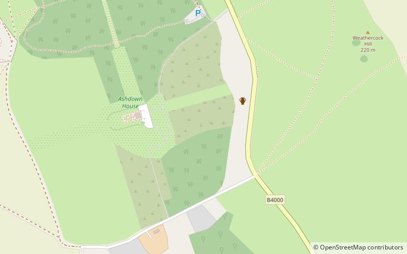
Ashdown Park is a 9.3-hectare biological Site of Special Scientific Interest south of Ashbury in Oxfordshire. The SSSI is part of the park of Ashdown House. ()
Lambourn United Kingdom
Ashdown Park – popular in the area (distance from the attraction)
Nearby attractions include: Uffington White Horse, Wayland's Smithy, Uffington Castle, Dragon Hill.
 Famous hill figure and castle remains
Uffington White Horse
75 min walk • Carved into the rolling chalk hills of Oxfordshire, the Uffington White Horse is a prehistoric enigma that captivates the imagination of visitors and historians alike. This ancient hill figure, etched into the landscape over 3,000 years ago during the late Bronze Age...
 Archaeological site, Historic walking areas
Wayland's Smithy
55 min walk • Wayland's Smithy, nestled in the verdant landscape of Oxfordshire, United Kingdom, is a site steeped in ancient history and folklore. This Neolithic long barrow and chamber tomb, dating back to approximately 3,600 BC, is a testament to the architectural acumen...
 Archaeological site, Forts and castles, Mysterious site
Uffington Castle
73 min walk • Uffington Castle is an early Iron Age univallate hillfort in Oxfordshire, England. It covers about 32,000 square metres and is surrounded by two earth banks separated by a ditch with an entrance in the western end.
 Archaeological site, View point
Dragon Hill
82 min walk • Dragon Hill is a small hillock immediately below the Uffington White Horse on the border of the civil parishes of Uffington and Woolstone in the English county of Oxfordshire. In 1974 it was transferred from Berkshire.
 History museum, Museum, Vernacular architecture
Ashdown House, Lambourn
4 min walk • Ashdown House is a 17th-century country house in the civil parish of Ashbury in the English county of Oxfordshire. Until 1974 the house was in the county of Berkshire, and the nearby village of Lambourn remains in that county.
 Forts and castles
Liddington Castle
124 min walk • Liddington Castle, locally called Liddington Camp, is a late Bronze Age and early Iron Age univallate hill fort in the English county of Wiltshire. At 277 metres, it is the highest point in the Borough of Swindon. It is sited on a commanding high point close to the Ridgeway and covers an area of 3 hectares.
 Cemetery
Westmill Woodland Burial Ground
161 min walk • Westmill Woodland Burial Ground is a green burial ground in the Vale of White Horse on the border of Oxfordshire with Wiltshire in southern England.
 Area
AreaWanborough, Swindon
120 min walk • Wanborough is a large village and civil parish in the borough of Swindon, Wiltshire, England. The village is about 3.5 miles southeast of Swindon town centre.
 Church
St Andrew's Church
121 min walk • St Andrew's Church is in the village of Wanborough in north Wiltshire, England. It is an active Anglican parish church in the Diocese of Bristol, one of only three churches in England to have a western tower and a central spire.
 Forts and castles
Alfred's Castle
11 min walk • Alfred's Castle is a small Iron Age hill fort, situated at grid reference SU277822, behind Ashdown Park in the civil parish of Ashbury in Oxfordshire. It lies 2–3 km south of the Ridgeway and is protected as a Scheduled Ancient Monument.
 Memorial
Cotswold-Severn Group, Shrivenham
55 min walk • The Cotswold-Severn Group are a series of long barrows erected in an area of western Britain during the Early Neolithic. Around 200 known examples of long barrows are known from the Cotswold-Severn region, although an unknown number of others were likely destroyed prior to being recorded.
