Sankeys, Manchester
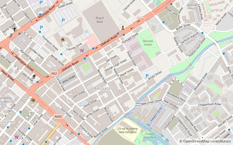
Map
Facts and practical information
Sankeys is a nightclub franchise with its first nightclub in Ancoats, Manchester, United Kingdom. The company currently operates a nightclub in Playa d’en Bossa, Ibiza and opened a New York City venue in 2013. ()
Coordinates: 53°29'9"N, 2°13'36"W
Getting there by public transportation
Public transportation stops near this location
- Bus
- Tram
- Train
 Bus
Bus
- Calculate routeShudehill/Mayes Street 11 min walk
- Calculate routeDale Street/Oldham Street 11 min walk
- Calculate routeSHUDEHILL/Thomas Street 12 min walk
- Calculate routeCHURCH Street/Tib Street 12 min walk
- Calculate routeNew Islington 11 min walk
- Calculate routeShudehill 14 min walk
- Calculate routeMarket Street 15 min walk
- Calculate routePiccadilly Gardens 15 min walk
- Calculate routeManchester Piccadilly 16 min walk
- Calculate routeManchester Victoria 18 min walk
- Calculate routeManchester Oxford Road 27 min walk
- Calculate routeArdwick 30 min walk
Maps MetrolinkMaps
 Metrolink / Rail
MetrolinkMapsMetrolink / RailDay trips


Frequently Asked Questions (FAQ)
Which popular attractions are close to Sankeys?
Nearby attractions include Murrays' Mills, Manchester (4 min walk), Royal Mill, Manchester (4 min walk), Ancoats, Manchester (6 min walk), Great Ancoats Street, Manchester (9 min walk).
How to get to Sankeys by public transport?
The nearest stations to Sankeys:
Bus
Tram
Train
Bus
- Shudehill/Mayes Street • Lines: X43 Fast (11 min walk)
- Dale Street/Oldham Street • Lines: 2, 2 (peak) (11 min walk)
Tram
- New Islington • Lines: Asht, Eccl, Mcuk (11 min walk)
- Shudehill • Lines: Airp, Altr, Bury, Picc, Vict (14 min walk)
Train
- Manchester Piccadilly (16 min walk)
- Manchester Victoria (18 min walk)