Trek Zone

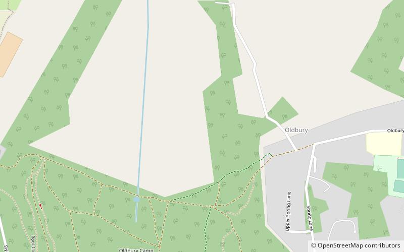
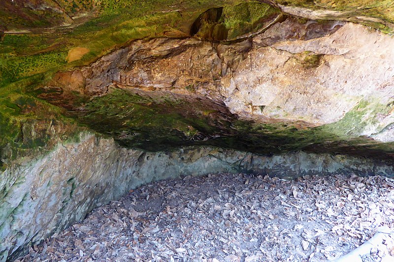
Oldbury rock shelters, Kent Downs

#26 among attractions in Kent Downs

Archaeological site
Oldbury rock shelters

Facts and practical information

Coordinates: 51°17'10"N, 0°16'10"E
Address

Kent Downs United Kingdom

ContactAdd
Social media
Add

Kent Downs plan & book

Unleash the traveler in you — discover the cheapest flight deals, find the perfect hotel or hostel nearby, and search for the best car rental prices. Travel at your own pace to discover new places and enjoy your journey.

Day trips

Oldbury rock shelters – popular in the area (distance from the attraction)

Nearby attractions include: Knole House, Ightham Mote, Otford Palace, Oldbury Camp.

  • knole house sevenoaks3.1 miSW
  • ightham mote sevenoaks1.9 miS
  • otford palace3.8 miNW
  • oldbury camp kent downs0.6 miSW
  • vine cricket ground sevenoaks3.3 miW
  • west malling golf club4.4 miE
  • fackenden down kent downs4 miNW
  • kemsing down2.7 miNW
  • ivy hatch nature reserve kent downs1.2 miS
  • west kingsdown windmill kent downs location map
    3.5 miN
  • riverhill house sevenoaks3.8 miSW

Frequently Asked Questions (FAQ)

How to get to Oldbury rock shelters by public transport?

The nearest stations to Oldbury rock shelters:

Train
  • Kemsing (32 min walk)

Where to next? Visit england England region page or discover the top tourist attractions in United Kingdom.