Rowanfield, Cheltenham
Map
Facts and practical information
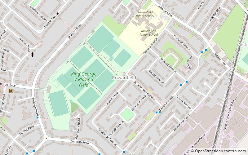
Rowanfield is a neighbourhood in Cheltenham, England. It consists primarily of a social housing estate of Wimpey no-fines houses and low-rise flats, built around 1953, with Rowanfield School and a playing field to the West separating it from Hesters Way and also the older Rowanfield Road to the East. To the south-west Rowanfield borders the district of St Mark's. Rowanfield is located 1.5 miles west of the centre of Cheltenham. ()
Coordinates: 51°54'11"N, 2°6'17"W
Address
Cheltenham
ContactAdd
Social media
Add
Getting there by public transportation
Public transportation stops near this location
- Bus
- Train
 Bus
Bus
- Calculate routeCheltenham Spa 12 min walk
- Calculate routeHarrington Drive 22 min walk
- Calculate routeRobert Burns Ave 30 min walk
Day trips


Frequently Asked Questions (FAQ)
Which popular attractions are close to Rowanfield?
Nearby attractions include Hesters Way, Cheltenham (15 min walk), Arle, Cheltenham (18 min walk), The Bacon Theatre, Cheltenham (19 min walk), Benhall, Cheltenham (23 min walk).
How to get to Rowanfield by public transport?
The nearest stations to Rowanfield:
Train
Bus
Train
- Cheltenham Spa (12 min walk)
Bus
- Harrington Drive • Lines: 97, 98 (22 min walk)
- Robert Burns Ave • Lines: 97, 98 (30 min walk)