Ingrebourne Valley, South Ockendon

Gallery (1)
Map
Map
Facts and practical information
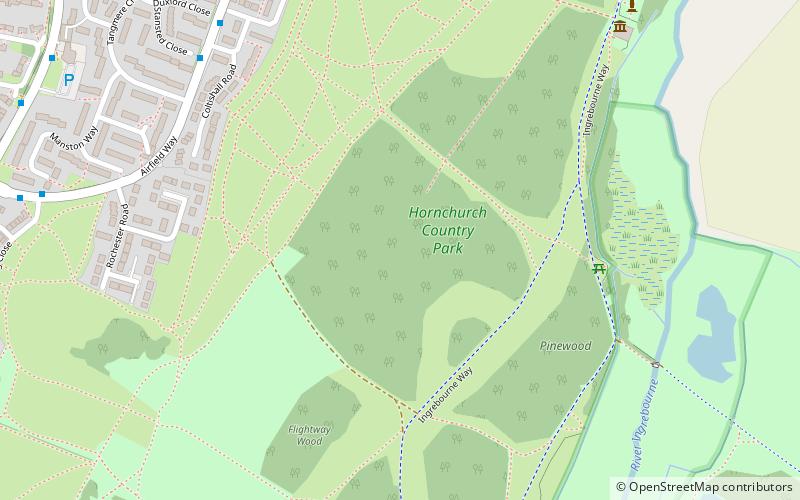
Ingrebourne Valley is a local nature reserve in Hornchurch in the London Borough of Havering. It is owned and managed by Havering Council, and has a visitor centre managed by the Essex Wildlife Trust. Most of it is in Hornchurch Country Park west of the River Ingrebourne, but there are also areas north and south of the park which are part of the LNR. It has a wide range of habitats, including woodland, grassland, the river and marshes. It is an important site for a range of species of plants, animals and birds, including great crested newts, slow worms, the harvest mouse and the water vole. ()
Area: 1.01 mi²Elevation: 36 ft a.s.l.Coordinates: 51°32'17"N, 0°12'36"E
Address
Havering (Elm Park)South Ockendon
ContactAdd
Social media
Add
Getting there by public transportation
Public transportation stops near this location
- Metro
- Bus
 Metro
Metro
- Calculate routeGosport Drive 7 min walk
- Calculate routeDowding Way 9 min walk
- Calculate routeHeron Flight Avenue 10 min walk
- Calculate routeSarre Avenue 10 min walk
- Calculate routeElm Park 25 min walk
- Calculate routeHornchurch 30 min walk
Day trips


Frequently Asked Questions (FAQ)
Which popular attractions are close to Ingrebourne Valley?
Nearby attractions include Hornchurch Country Park, South Ockendon (2 min walk), St John's Parish Church, Dagenham (16 min walk), Hacton, South Ockendon (19 min walk), London Borough of Havering, South Ockendon (23 min walk).
How to get to Ingrebourne Valley by public transport?
The nearest stations to Ingrebourne Valley:
Bus
Metro
Bus
- Gosport Drive • Lines: 252, 652 (7 min walk)
- Dowding Way • Lines: 252, 652 (9 min walk)
Metro
- Elm Park • Lines: District (25 min walk)
- Hornchurch • Lines: District (30 min walk)