Shoreditch Park, London
Map

Map

Facts and practical information
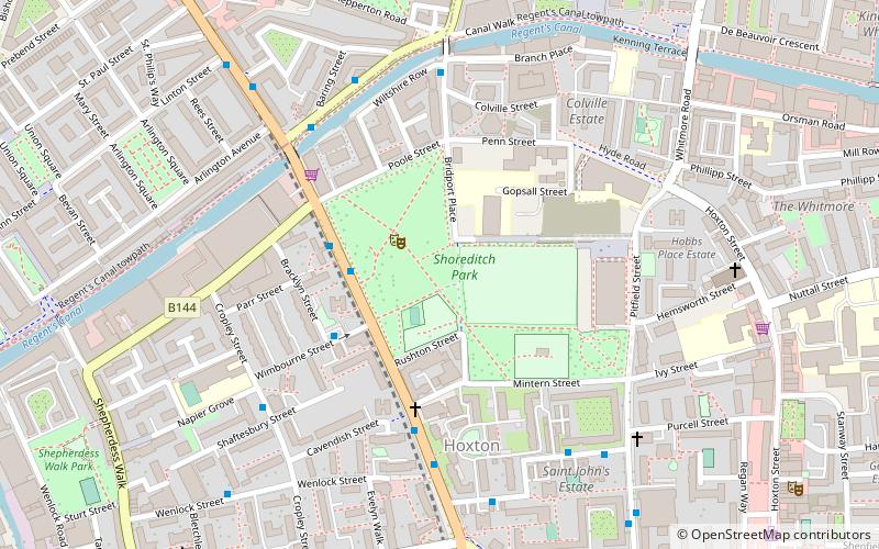
Shoreditch Park is an open space in Hoxton area of Shoreditch in the London Borough of Hackney. It is bounded by Poole Street, Rushton and Mintern Streets and New North Road and Pitfield Street. The park derives its name from the Metropolitan Borough of Shoreditch, the local authority when it was established. The park is 7.7 hectares in extent. ()
Elevation: 56 ft a.s.l.Coordinates: 51°32'4"N, 0°5'12"W
Address
Hackney (Hoxton)London
ContactAdd
Social media
Add
Day trips
Shoreditch Park – popular in the area (distance from the attraction)
Nearby attractions include: Museum of the Home, Ironmonger Row Baths, Shoreditch, Power Lunches.
Frequently Asked Questions (FAQ)
Which popular attractions are close to Shoreditch Park?
Nearby attractions include Rosemary Branch Theatre, London (6 min walk), Hoxton, London (8 min walk), Hoxton Hall, London (9 min walk), St Monica's Church, London (10 min walk).
How to get to Shoreditch Park by public transport?
The nearest stations to Shoreditch Park:
Bus
Train
Metro
Bus
- New North Road • Lines: 394 (3 min walk)
- Mintern Street • Lines: 394 (4 min walk)
Train
- Hoxton (14 min walk)
- Haggerston (15 min walk)
Metro
- Old Street • Lines: Northern (16 min walk)
- Angel • Lines: Northern (21 min walk)

 Tube
Tube


